Our last visit to Oriental on Pandora…

It’s Thursday morning and Pandora is secure on one of the FREE public docks here in Oriental.  We arrived yesterday after a short 35nm run from the bight of Cape Lookout.  

Our visit to Cape Lookout was wonderful, if a bit cool and rainy.  Perhaps that was for the best as the weather certainly enhanced the primeval mood of the place.   That’s Brenda way-out-there…  “Brenda, can you hear me now?”  Nope…Lots of sea birds.  These are migratory terns, visiting from the Arctic, I think. Don’t ask me what type as we left our bird book home in CT.  Oh well, let’s just call them terns for now. Many dolphins visited us while we were anchored.  It’s maddeningly difficult to get a good shot of these beautiful animals.  This is a dolphin fin, in case you can’t tell.  I guess you had to be there.Brenda and I took several walks on the beach, especially to so some shelling.  Of all the beaches we have visited, we have never been on a beach with more shells.  The selection wasn’t that great but there were tons of them.   This shot is of one particularly rich area.  Loads and loads.  “Bob, is the picture upside down?”  Not sure. With the exception of a few campers we had the beach to ourselves.  No exaggeration, the beach went on for miles.   Pretty amazing.  Why someone would choose to camp on sand is a mystery to me.  Sand on my feet is bad enough.  Sand EVERYWHERE… Yuck!.  .

Nice haul…What a great lighthouse and newly painted. Brenda “set a moment” on the keeper’s house, now museum.Back in the “pre GPS” age, mariners would spot a light during the day and to help them identify, sort-of where in the Hell they were, each was painted with a distinctive pattern.  Cape Lookout light, all 185’ of it, was painted with a very distinctive diamond pattern.  The white diamonds were oriented north to south and black to east to west.  Or was it the other way around?  Not certain.  Sure glad that we have a plotter and GPS.

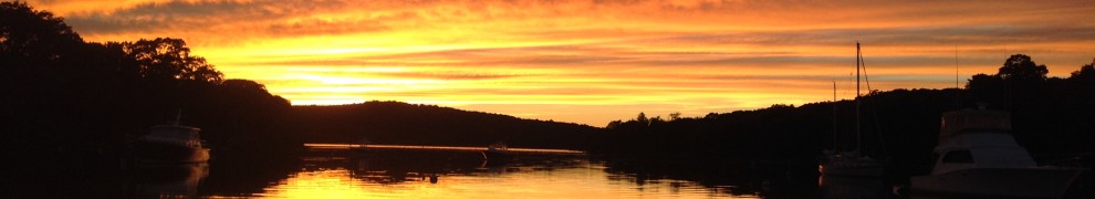
Big painted diamonds on a 185’ tall lighthouse or not, literally hundreds of ships foundered on the nearby shores.   Happily, not Pandora.  However, when we were leaving yesterday morning, we had to pick our way out of the bight in fog with a visibility of about ¼ mile for the 6nm to Beaufort Inlet.    The sunrise was spectacular.  At least I think it was the sunrise.  Hard to say in the fog.We had heard on the radio that the Coast Guard was re-positioning markers in the Beaufort inlet so we were cautioned to be particularly diligent as we came up the channel.   I wouldn’t want to bump into them.  The ship made the huge marker look positively diminutive.  Either that or the people on deck were Lilliputians.   Hmm…It wasn’t long before the ship faded into the fog.As we made our way through the marsh, north of Beaufort, we enjoyed watching the homes go by.  “Dammit Gladys, why does everything that comes into this house have to be in frigging primary colors?”  Anyway, we are now in Oriental, home to “free docks”.  Now, that’s not something that you see in Martha’s Vineyard.   Nice dock tucked next to the commercial docks.  Can you say “big red boat”.   Sure makes Pandora look teeny.We met a nice gentleman across the dock from England who “crossed the pond”  a while back and is now sailing in US waters with his black kitty.   Mogs, a cute little boy kitty, visited Pandora and perched on the sail cover.  Nice kitty…We couldn’t tell if this tern was scolding Mogs or asking for cheese and crackers as he “stared us down” from a nearby piling.So, here we sit, aboard Pandora in lovely Oriental NC, a stones throw from New Bern, where we are headed tomorrow.  I have to say that we Brenda and I are getting a bit nostalgic knowing that we will soon be separating ourselves from our life aboard Pandora, something that has consumed much of our time for years.

It’s certainly bringing back many memories and I expect it’s not going to feel  great as we remove everything from her lockers and drive away a week from now.  Not terrific, in part, because we’ll soon be two-boat-owners.  I don’t know exactly how many miles Pandora has taken us over the last 8 years but it’s certainly been a great ride (if sometimes less smooth than Brenda would hope for) and we are going to miss her. Editor: I meant miss Pandora, not Brenda to be perfectly clear.

Well, today we will just have to work hard to make our last day aboard Pandora, here in Oriental, the best it can be.   Yes, that’s the spirit.

Enough of that, it’s time to make coffee.  Yes, that will make everything better. Well it will make it clearer, at least.  “Bob, NO it won’t… You drink decaf.”

Got it, decaf.

Lookout at that Cape…Beautiful.

It’s Tuesday morning and we are anchored in the bight at guess what– Cape Lookout.  What a spot.  The lighthouse at Cape Lookout is unique, white with black diamonds painted down the sides.     Cape Lookout is located about equidistant between Beaufort NC and Cape Hatteras.  Actually, to look at a chart you’d think that this was part of Cape Hatteras, which it, sort of, is.  Anyway, a nice place.

This is a very remote spot and as I write this there is only one other boat within view and they are perhaps ¾ of a mile away.

Lookout is an area of miles of shifting sand dunes and as we rounded the point yesterday I was amazed to see that the two buoys marking the approach aren’t on station at all.  If you were to round them normally, you’d run hard aground.  That’s pretty obvious on the Garmin i-pad charts but my Raymarine plotter, with older charts, shows just how much the sand has migrated over the years.   In fact, one of the floating marks is actually in about 1’ of water at low tide.  Not exactly in the right position at all.

However, after rounding and not grounding, we were greeted by a lovely view of the lighthouse in the late afternoon light. After a few days in Wrightsville Beach we left yesterday to make the run here, an ocean shot of over 75nm.  We had debated going on the inside but there is so much shoaling in the ICW along the stretch to Beaufort that we expected it would take three days to make the run because of the timing of the tides, low at mid day.  I have gone through that section twice before but the tides were high in teh middle of the day so it worked just fine.  Transiting much of NC needs to be managed that way.

We headed out of the inlet with Kismet at dawn and were greeted by a beautiful sunrise framing our friends and their boat. Actually, there’s was the only boat we saw for the whole day.  I guess everyone else was at work after a long Easter weekend.

By going outside we were able to make the run in a single day what would have taken three short days inside, and all during daylight.  However, it didn’t turn out to be a great day for Brenda as there was a swell coming in on the beam the entire day and there was only a light breeze on the nose which meant that there wasn’t anything to stabilize the boat.  After about 11 hours of the boat rolling from side to side in the swells, a nice breeze finally picked up, but not until we were only a few miles from our destination.  Oh well, not a lot of knitting for Brenda yesterday.

However, we were able to anchor in time to enjoy the sunset and a nice steak dinner.  A good ending after a long day.  We had decided to visit Cape Lookout as our new friends Laurie and Jim of Kismet had told us about this spot and encouraged us to visit. 

So, we plan on staying here for two nights and then we’ll make the rest of the run to New Bern beginning early Thursday for a Friday arrival.  Happily, the flood up into the Beaufort area coincides nicely with our plans to make the 10 mile run to the inlet from here on Thursday morning.

This is an amazing place and while it’s only a short distance from a populated area of NC (there’s even pretty good cell coverage) and yet it looks like a spot that could easily be a thousand miles from anywhere.

This is the view of the lighthouse that greeted me at sunrise today.   After a few shots, I was even able to time the photo to coincide with the flash of the 15sec light.  Wow!  Can you say Wow first thing in the morning?  I did…Today we’ll be heading to the beach for a walk and some shelling, something that we’ve been told is terrific here.

I am excited and yes, this truly is a great spot to “look out”…at.

Wrightsville Beach for a few days, or not.

It’s Easter morning and I have to say that it feels a bit weird to be sitting here as if it’s just any day of the year.  However, it’s blowing pretty hard and we didn’t feel like heading ashore just yet.    However, I did make fresh biscuits for breakfast so it felt a bit special. 

Just in case you were wondering how our run with the current up the Cape Fear River  (Brenda just loves the name of that river) went, well wait no longer.   Here goes…

My plan was to hit Southport and head up the river at slack tide, about 2:00, two days ago.  Unfortunately, I neglected to note that the river doesn’t turn with the tide at Southport at all.  “That’s right Bob.  It’s CURRENT, not tide”  So, as we headed out into the river we began bucking a 4kt adverse current and did so ALL THE WAY up the 10 miles to our destination.   Fortunately, there was about 20kts of wind on our stern so, while the water was plenty lumpy, with wind against the current, we were able to motor-sail with the jib all the way.  In spite of our boat speed of nearly 9kts at times, we crawled up the river, against the current at a crawl, sometimes less than 4kts over the bottom.  Had the current been with us, we would have made the 10 miles in about an hour but it took us 2.5 hours instead.

Anyway, we made it, even if it took a lot longer than expected.  I guess we were just paying penance for our good run, with the current, going to Calabash the day prior.

We picked up a mooring in Carolina Beach which was a good idea as the wind blew hard overnight and we definitely felt more secure on a mooring as the wind gusts peaked at nearly 30kts.

Yesterday we made a short 10 mile run from there to Wrightsville Beach where we are now.

Along the way we only ran aground twice but that was to be expected as we passed a number of small inlets where the currents cause lots of shoaling, a particular problem here in NC.  And to make matters worse, the tide was low mid morning so we had even less water to work with.  I recall that on our run here two years ago, we had problems then too.

With all the shoaling problems to address, we passed a number of dredges, one was over 400’ long working in a major inlet.  This one was much smaller.  I was struck by just how tiny this tug pushing the dredge barge was.  I can’t imagine that it would even float without being attached to the barge.We also passed a number of shrimp boats tied up on local docks.  They look great in this picture but close up they clearly need a bit of TLC.  It’s got to be tough to compete with the low price of farm raised shrimp.  Nice lines though.From here we have about 80 miles to Beaufort where we will head north to New Bern.  I mention this because this next section is particularly prone to shoaling and low tide is late morning each day.   This means that we will have a very tough time making distance with the lowest water happening in the middle of the day.  The best way to make it over shoals is to time our passage when high tide hits in the middle of the day, something that we were able to do in GA which made it possible to cover some pretty good distances in spite of grounding hazards.  

We had a nice couple, Jim and Laurie from Kismet, over for cocktails last night and they mentioned that they planned to make the run to Beaufort offshore because of the shoaling and tide problems.    And, as the run from here if 70 miles, they planned to jump out at dusk tonight and time their arrival in Beaufort for dawn and a rising tide, which will make it easy to run up the river.

Brenda, who doesn’t really like sailing in the ocean and much less at night, seems intrigued by the idea of sailing in company with them so perhaps we’ll do it.  The only negative is that it’s pretty windy as I write this and it’s from the wrong way.   However, the winds are supposed to drop considerably this evening so perhaps we’ll give it a try.  It will be a motorboat ride anyway but much more appealing than bumping along the shoals of the ICW.   Besides, because of the timing of the tide, it would take three days on the “inside” to do what what we will be able to do in a single night on the “outside”.

I don’t know what we will do yet as it depends on what the winds do this afternoon.  If they settle down I expect that we will make the jump outside and if we do, we may very well stop at Cape Lookout National Seashore, just south of Cape Hatteras for a few days as we have heard that it’s a very beautiful area.

So, is it Wrightsville Beach for a few days or will we leave tonight?  I guess we’ll have to see what happens with the winds this afternoon to know if we are staying our going.  And you, dear reader, will have to check back to find out.

I guess that’s all for now.

Nearly there. Calabash River on the SC and NC border.

It’s Friday morning and I am not certain if I am in South or North Carolina as it depends on whether I am on the south side, north or perhaps the center of the Calabash river that marks the border of the Carolinas.   Oh well, I am definitely here in “the Carolinas” and not far from our destination, New Bern, which is only about 200 miles from here.   Considering that we have gone over 1,500 miles on this trip since leaving St Mary’s in early January, it’s just stone throw.

Our plan for today is to head about 30 miles to Southport at Cape Fear (Brenda just loves that name and all that it conjures)  with the hope of timing our arrival at the Cape Fear River to coincide with the tide flood as that will give us a boost with the incoming current for the remaining 10 mile run up river to Carolina Beach.

We understand that there is a restaurant there that will let boats tie up for the night if you have dinner with them.  That sounds good to me so I guess the only question is if they will have room at the dock for Pandora.  If not, we’ll take a mooring in the harbor and explore the town via dink.  Being on a dock would be a nice change of pace.

Yesterday we had a very nice run of about 55nm through some of the most beautiful “low country” we have seen yet.  As a special bonus, we were able to carry a fair current nearly the entire way, something that hardly ever happens.  The only foul current we encountered was for the last few miles before we arrived at the Calabash River as the tide had started to flood.   It was important for us to make good time to get here as there are very few places to anchor along this particular stretch and the only option before Calabash was hours south and the next anchorage quite a few miles further up the line.

Along the way we went through miles of marshes lined with Bald Cypress, so named because they loose their needles in the winter.  We particularly enjoyed watching seeing the wildlife as we motored slowly by.

There were turtles lined up on logs everywhere as the water in this area is fresh.  I wonder if the one at the end started there or was “pushed” along by late arrivals.  “Hey Yurtle, yeah you, move up a bit and make room?”We also saw many osprey nests.  This one was perched on a navigation aid, a very popular choice, it seems.It’s always fun to look at the homes that line the waterway here and along with the huge monstrosities that are such a part of “waterfront living”, we were struck by the color of this one.  Boy, I sure hope that the neighbors like purple and pink.  Yow-za…I’ll bet that they will have to reconsider their paint scheme when it comes time to sell. 

I can’t begin to count how many bridges we have gone past in our travels but I guess that the SC highway department has decided that they need one more.   It surely looks like a huge job .  I wonder how long it takes to complete a bridge of this magnitude.  Years?   We will just have to wait and see how progress is going on our next trip through the area.

Well, writing this isn’t getting the coffee on and Brenda’s up so I guess I’m done for now.

The sights, sounds and smells of Georgetown SC.

It’s Wednesday morning here in historic Georgetown and it’s going to be a lovely day indeed.

This will be our third day here and it’s going to be tough to leave.  The town has a lovely waterfront area including a boardwalk that runs down the length of this tiny harbor.  Speaking of tiny, we are anchored off of the town dock which is very nice and convenient.  However, the harbor is so narrow that we have had to re-anchor more times than I want to admit as each time the wind shifts, and shift it does, we have to up and reset the hook so that we don’t end up too close to some boat or dock as we shift to a new direction.

And to make things even more exciting, the wind has been coming from a variety of directions and it really pipes up each afternoon so that our chain is stretched tight, making us feel that if our anchor shifts (drags) in the soft mud bottom even 20’ that we will end up too close to something hard and pointy.   We prefer not to be really, really close to “hard and pointy”.

So, aside from the “having to re-anchor” thing, it’s really a lovely spot.

Georgetown is a town of “contrasts” with beautiful homes and old civic buildings as well as a nasty steel mill (are there steel mills still in the US?) and a stinky paper mill to boot.  To look in one direction you see a beautiful waterfront and turn your head and you’ll see the paper and steel mills.  Not so beautiful.  And, when the wind comes from the “right” direction, the paper mill smells like a stale brewery.  However, for us, the good definitely outweighs the bad.

For the two days we spent motoring here from south of Charleston, we have “enjoyed” some really shallow spots.  Because of the high tides, around 7’, along the 70nm run, you can use the tides to get over the shallow spots but that means making the run on a rising tide.  And that meant that we had to time our departures each day to coincide with rising tides which meant that sometimes we had to wait till mid morning to depart which somewhat restricted out travel time and distance before the sun and tide went down again.  However, we made it and here we are.

About 10 miles south of Georgetown, we anchored along one of the canals in a lovey windy creek nestled in rice fields.  The view was spectacular with birds everywhere, including a bald eagle perched on a tree that watched us as we motored by.   After a while he took flight and circled us.  A bit blurry, perhaps because I wasn’t quite awake yet but impressive, never the less.  The canal is as straight as a highway.  However, you don’t get this sort of “big sky” view on just any “road”. I can’t say that it’s clear to me what the purpose of this watch tower is but I expect it has something to do with the rice fields.   It looked pretty nice in the early morning light.We also passed a floating bridge in the canal.  It was quite interesting as the “barge/bridge” was just the right length to fit between the two landings on each side of the canal.  The barge appears to be fixed at one end to a piling on shore and pivots with a large rotating “outboard” that moves the other end of the barge into position on the opposite shore.  Once in position, ramps are lowered on each end of the barge and vehicles can cross.  It’s an ingenious piece of equipment.  Note the “outboard” on the end of the barge.  I think it’s run by hydraulics from a large stationary diesel engine on deck.   I guess it’s pretty heavily used by vehicles in the rice fields as there were plenty of pickup trucks parked on both sides of the canal. So, back to Georgetown.

We walked the mile or so out to the Piggly Wiggly grocery for some fresh food and were struck by how different the food that they stocked were there verses what we are used to in CT.  The produce section was very small and was dwarfed by the baked goods, mostly cakes and pies.  “Forget the apples, I’ll have a case of Little Debbie danish.” Oh yeah, and lots of fried pork rinds too, it seems. There was also a huge variety of grits to choose from.  The meat cases were loaded with all sorts of smoked items, mostly unrecognizable but these were labeled as “smoked pork necks”.  Yum… There was also piles of “meat by-product” looking stuff labeled as “sousa” and “blood pudding” in the meat section.  They were thick slices of what looked like a soft and lumpy bologona.   I expect that you DO NOT WANT TO KNOW what’s in it.  However, it’s not expensive.

Setting aside the grocery experience, the town is really quaint.  This old building houses the local “Rice Museum”, which we are going to check out today.  There is also a really nice little nautical museum.  They had some really well done models. I particularly liked this river boat.  We also went out for lunch at a riverfront cafe.  There was a spectacular and huge, salt water aquarium.  It was clearly a very well cared for tank.  Notice the soft corals.  I expect that they aren’t feeding them smoked pork necks.    We went for a walk down a few of the nicest streets, lined with beautiful live oaks. We particularly admired this beautiful home, two hundred years old this year.  It turns out it was for sale and we were invited in for a tour.   “Hi, want to take a look inside?”  Sure…Each room was more beautiful than the last.  The place was absolutely packed with antiques.The place looked like it had just been renovated, and it was, in preparation for sale.  The asking price, $1.5m, complete with all furnishings and they’d even throw in a brand new Land Rover.   I can’t even imagine what this house would be worth in Essex. 

I suspect that this is a very full price for this area but the antiques along must be worth a good deal.  Supposedly, the owner buys homes, fixes them up and sells them.  I guess he must have some sort of antique business to fill them with so much stuff.  “I’ll take it but you’ll have to knock off $10,000 as I just can’t live with that sideboard in the sitting room.”

Anyway, nice house.

As we make our way up the ICW we often see boats that we have seen before. This lovely little trawler has been stopping at some of the same places as we have since central Florida and we keep seeing them along the way.  It’s very well kept and has really sweet lines. All and all, we really like Georgetown however, time marches on so I guess we will have to head out tomorrow.  We have to be in New Bern on the 11th and still have over 200 miles to go.

The next few weeks are going to be very busy as we unpack Pandora and get her ready for sale.  I’ll bet that we’ll find things in lockers that we have long forgotten.

And, I won’t even talk about the logistics of renting cars, storage units, going to wedding in Columbia SC, arranging for hotels, a flight home for Brenda and closing on a new boat.  Yikes!!!  As Scarlett O’Hara, sort of, once said “I won’t think about that today, I’ll think about (logistics) tomorrow.”  

Speaking of plantations and the old south, perhaps we’ll have to visit the rice museum.   Yes, that sounds good.  Well, we’d better get going.  

Yep, outrunning spring weather. Burr…

It’s Sunday morning and the temperature went down into the 30s last night so we left the heater running all night.  That worked out pretty well.  Glad that we have it.  It is supposed to get warmer in the next few days but these cold fronts are wreaking havoc on the weather here.  I had feared that we would encounter pretty cold weather by being this far north so early.  No disappointment on that score, unfortunately. 

Anyway, cold or not, we are anchored just outside of Charleston in a very narrow section of the ICW, Elliott’s Cut.   The current runs like mad through this narrow cut with currents on some points of the tide at around 4kts.  The cruising guide suggests transiting it with the tide.  Good thought.  I’ll keep that in mind.

Speaking of tides and currents, our lives since entering GA waters days ago have been governed by the tides.  Actually, it’s all about not running aground as there are many areas of the ICW that are very shallow due to major cuts in the Army Corps dredging budget over the last few years.

Today, for example, here near Charleston NC, we have to stay put until we can time our transit of a particularly shallow part of the ICW to be sure that we hit it on a rising tide.  With our draft of just under 6’ we are on the upper limit of water depth, about 2′ too deep at low tide, in a particularly nasty section of about 8 miles that we have to get over today.  However, with a tide range here of nearly 6′ we can time our transit to get “over the humps”.  Fingers crossed…

Ever since entering GA it’s been tough with so many shallow sections.  However, with a tidal range of 7-9’ it’s not too difficult to make transit as long as you are willing to leave with the tide.  Sounds easy and it is.  However, sometimes it means that we have to wait till mid-morning to leave which severely limits the miles we can go before evening puts an end to the day.   The worst part that we have to transit today is just north of Charleston and low tide is at 10:30 which means that we really can’t leave here until shortly before that time.

Our next stop is Georgetown SC, a spot that we have heard is quite nice and quaint.  Given our “tide inflicted” late start today, I doubt that we will make it all the way there today.

Shoaling and cold besides, we have enjoyed our run over the last few days.  In particular, we had a nice time in Beaufort, SC where we stopped for a visit.  We had spent time there a few years ago when we last came through and it was nice to be back.  I wrote about that visit in this post.

I won’t repeat that here except to say that it’s still lovely.  While we were in town a strong front came through and dumped loads of rain. The sky looked particularly ominous as it approached. One great thing about changing weather is that it made for a great sunset just in time for cocktails.So, cold or not, I guess that I had better get on with it.  Hope we don’t run around too many times today and let’s hope that spring catches up with us soon.  Burrrr…


A fun time in Savannah. Heading north…still.

It’s Thursday morning and today we head out from Savannah after two days of exploring the historic district.  Last time we visited this city we took Pandora up the river and tied up at the city dock.  It turned out to be a “not great idea” as we bucked some remarkable currents and also picked up a nasty poly tarp in our propeller along the way.  All worked out well in the end, but it was a bit harrowing at the time.  I wrote about that experience here.

This time, to keep things a bit less exciting, we opted to tie up at a marina in a nearby town Thunderbolt, that was named, legend has it, by native Americans for a fresh water spring that “sprung” when it was struck by a powerful bolt of lightning, way back when. By staying here we were able to avoid the long run up the Savannah river and all that comes (see fun experience referenced above) with being in a busy shipping port.  This is a very convenient spot and there’s even a nearby city bus to take us into the city center and to do a bit of provisioning.

Besides, they even give you Crispy Crème donuts each morning, delivered to your boat.  Believe it or not, I have NEVER had a Crispy Crèam donut, EVER. Now I have…

Anyway, we enjoyed being in the city again and walked all over, taking in the sights.   With the risk of repeating myself from our last visit, you might want to take a look at that post from a few years ago.

We discovered that there was a nice little maritime museum in town, the Ships of the Sea Maritime Museum.  It’s a lovely spot and as an added benefit, they even have some terrific gardens on site.  It seems that they host events on a regular basis and what a spot it is. You enter the main entrance to the museum through the gardens.  It’s a lovely spot and the museum is housed in an old mansion.  Very tranquil.While the museum is not particularly large, they have a nice collection of good sized models, the sort made for ship owners and, as you can imagine, there is a focus on Savannah history.   In fact, they have a LOT of models of boat named, you guessed it, SAVANNAH, including the only nuclear powered cargo ship, the… SAVANNAH.   It was launched during the Eisenhower administration as part of the “nuclear for peace” initiative. Oops, it didn’t work out particularly well and the ship was soon retired as too costly to operate.  Nice model though, even if the photo isn’t so great.

And this ship was also called…the Savannah.  The Civil War looms large as a part of the history of the area and there were some really nice models depicting ships of the period.   This model of an ironclad was great and easily 6′ long. Particularly nice detail of the engine room in a cut out area. Beyond the Savannah themed ships, there are plenty of nice pieces to admire including a good collection of scrimshaw.  What nautical museum is complete without a bunch of carved whale teeth?Brenda particularly liked the piece with a sheep carved on it?  Now, how often do you get to see sheep carved on whale teeth?  Perhaps only in Savannah.  Well, that’s been our experience. The gardens were a hit with Brenda who particularly enjoyed the gardens.   She was a good girl and even looked at the ship models.  “Oh Bob, I do so love looking at ship models”.   She was a good sport.  Me, I even went into a knitting store with her, just to prove what a good guy I am. 

There are some really nice gardens in the city and I think we walked through each of the dozen in the historic area…twice.  Beautiful settings.  I’ll bet that the prices of homes around these gardens are a LOT more expensive than those in more, shall we say, “pedestrian” settings.When I see folks taking each other’s pictures, I always offer to take one of them. Of course, they nearly also say “would you like me to take one of you?”  Yes, that would be lovely. There is nearly always some sort of historic ship reproduction visiting the waterfront area.  This time, the Pinta and Santa Maria, of Columbus fame.  I heard that the Pinta ran aground coming into the city.  Nice to be in good company given Pandora’s track record to date of finding the shallow spots.

Speaking of experiences that, shall we say, raise one’s blood pressure.  There is always the Savannah Serenity House to help bring things back in balance.  Alas, there was no hope when we visited as even they were having a bad day.  Note the sign on the door?  “Now Bob, do you have to be so insensitive?”   Yes, you’re right. I take it back.

Well, I had better wrap this up as is’t almost time to check and see if our supply of Crispy Creams have arrived. Yum.

Through Hell (Gate) and beyond…

It’s Monday afternoon and we are anchored near Savannah and enjoying a rainy (chilly) afternoon “nesting” aboard Pandora.  It has taken us three days to make it here from the most northern part of Florida and even though we have only traversed a little over 80 miles from Amelia Island, our last stop in FL, we have wound around a total of 128 miles through the water.    Now that’s a lot of meandering.    

There is just no way to go from there to here in even close to a straight line.  And, unless you are willing to do an overnight run in the ocean, you just have to motor the entire way inside.   However, Brenda doesn’t particularly like the “overnight thing” and besides, the winds this early in the season are pretty much out of the north so inside we went.  Had we waited for favorable winds, we’d still be in FL as they aren’t forecasted to arrive for nearly a week from now.  Later in the season, when we are well into spring, north will give way to more helpful southerly.    Alas, with the “We have to be in New Bern” itinerary, inside it is.   

I will say that the view of the marshes along the way is beautiful.

This shot of the plotter gives you an idea of the meandering track I am talking about.  To do this run without good charts would be very tough as it would be very easy to loose track of where you are.   You can see the icon of Pandora in the lower center of the plotter.  That’s us making our way through the maze of channels. The Georgia stretch of the ICW has a reputation of being among the most difficult part of the waterway to manage if you have draft of more than a few feet as there is just so much shoaling.  However, it’s not as bad as you’d think as long as you are willing to time your trip so that high tide is in the middle of the day.  That’s because the tide range here is nearly 9’ , the highest of any part of the waterway.  So, if you can wait a week, from when low tide is mid day util it’s high mid day, you can make the run in water that’s quite deep.

So, if you can get going at the beginning of a rising tide you will have enough water for much of the day.    Besides, a good part of the GA ICW is quite deep, sometimes more than 20’, even at low tide.  So, what gives the area such a bad rap?

It actually gets down to only two areas, one called Mud Creek and the other Hell Gate.  Both of these areas, and they aren’t all that long, at a few hundred yards each, only have about 3’ of water at low tide so that stops most boats when the tide is low.  So, the strategy is to make your way to each of these areas and then anchor nearby and leave the next morning on a rising tide.  Fortunately, for sailboats, these two trouble spots are about a day’s motoring apart.  Pretty convenient, right?

For those who sail in New England, hearing “Hell Gate” conjures up images of the swirling water and fast currents of the East River in NYC where many ships have met their end.   However, the GA version of same is a lot different.  It’s a short dredged (well sort of dredged) cut between two rivers.  The problem with the GA HG is that the currents at both ends, and it’s only a few hundred yards long, are fierce, running about 2.5kts on both the ebb and flood, twice a day.

A dredge that would do an area like Hell Gate, which is very shallow and narrow, would be tiny, dredges, like this one on the St Mary’s river a few days ago, are huge.  This one loomed out of the fog at us as we passed the Navy Base.  Look how low in the water it is.  It was headed out to dump what it had sucked up earlier.  The signature on AIS said that it draws 36’ of water.  That’s really deep keel.While the current in Hell Gate itself is minimal, the flood running by both ends moves lots of sand into the cut and undoes the work of the dredge in short order.  Anyway, both Hell Gate and Mud Creek are areas that cause problems ALL THE TIME and make transiting GA a “pain in the keel”.  But wait, there’s more…

In spite of the meandering nature of the area, you also face currents in excess of 2kts most of the time.  So, for part of the day you are thankful for the “good current” that helps you zip along at nearly 8kts and then you curse it as your speed over the bottom slows to a crawl at more like 3.5kts when the current is against you.  I suppose that it all evens out in the end but somehow the “bad” current always seems to hit late in the day when you are thinking “are we there yet?”

However, now the worst is behind us and tomorrow we will check into a marina, our first on this trip, and spend a few days enjoying historic Savanna.

However, before I break, I’ll  include a few photos from our run through GA.

But first, a few more of some of the beautiful homes on Amelia Island.  This one is the largest in the historic district.  It’s now a B&B.  I’d like to have the tower room please.   I had to pry Brenda’s fingers off of the porch railing to keep her from checking in.  Success!!!This porch is magnificent but it gives me a headache even to think about paying to have it painted.  Speaking of porches.  Brenda loves doorways and here are a few of her favorites.  Mine too.
As we left Amelia Island we passed an unlucky sailboat looking like anything but it’s name “Joy”.  We had seen this boat a number of times and were sorry to see her in such an unlucky spot.  I expect she dragged her anchor the other night when we experienced really strong winds while we were at Amelia Island.  That night we had opted for a mooring as we were concerned about the strong currents and wind causing problems with our anchor.  Perhaps the skipper of Joy wishes he’d done the same thing.  Perhaps it’s only luck that keeps us from having the same fate. After leaving Amelia Island we spent an afternoon walking on Cumberland Island, a national park donated by the Carnegie Family.    It’s a beautiful island with many walking trails and spectacular views.  The island is covered with ancient live oaks and palms.  It’s looks very primeval. At the southern end of the island wind-blown dunes dominate the landscape creating an other-worldly view.  You can click on this and it will get larger on your screen.The island was once owned by the Carnegie family and their grand mansion now stands in ruins.  It was once 30,000 sq ft and three stories.  It must have been an amazing place to visit. We learned that the estate had a staff of 300 at it’s peak.  Imagine the wealth needed to sustain such a lifestyle. The trees on the island are huge.  This Live Oak dwarfs Brenda sitting on a bench.There is much wildlife on the island including wild horses and turkeys.  We didn’t see horses on this visit, as we did last time, but we did see turkeys as well as hawks and plenty of other birds.  

Speaking of birds, for much of our run over the last two days we were followed by Arctic Terns who have been wintering in the south, like the rest of us other “snow birds”.  They followed close behind us and swooped in our wake to catch any fish or shrimp that we stirred up as we passed.Well, we made it through GA, Hell (Gate) and beyond.  I am really looking forward to the next few days when we explore old Savannah.

Well, I guess that’s about it for now.  It’s after 5:00 and opening time aboard Pandora so I’d better get on with it and publish this post.

Oh yeah, one last thing.  How about a shot of a beautiful sky from the other day?  The sun trying it’s best to burn through the haze.  Andn o post is complete without a sunrise, or sunset.  How about a sunrise? Well, I think that’s what it was.  Not sure… Well, it was pretty anyway. 

First day of spring. Headed to skinny…

It’s Friday morning and the first day of spring.  Marking the passage of winter is a big deal for those who live in northern areas where winters can be long and cold.  And, I think it’s safe to say that this winter has proven to be the sort that makes the “non-migrating” folks long for springtime and the hope that snow will melt soon so that they can “get on with it” and enjoy the outdoors again without risking pieces of their body freezing solid and falling off.

However, for folks that are fortunate enough to choose their climates based on the seasons, the dawn of spring brings a different sort of excitement.   Yes, I enjoy being aboard for the winters as cold has never been something that I look forward except if it’s an “adult beverage”.  However as the spring flowers begin to show themselves I get excited about spending the summer back in the CT River Valley and our “summer home”.

This year’s return north will be particularly nice as with it will come our new boat (assuming that the survey goes well), also Pandora but Pandora the Aerodyne 47.

So, as we continue our run north to New Bern where we will leave Pandora the SAGA 43 for the last time, I have to say that my thoughts are turning to our summer in CT.

Yesterday, the last day of winter, we spent ashore on Amelia Island FL and what a nice spot it is.  At first glance the two paper mills dominate the skyline and flood the area with a low rumble of machinery running 24/7.   However, don’t be fooled as the town is really lovely as this view from the mooring field testifies.  Once ashore you are greeted by a wonderful main street shopping area.  Very southern.Along with the many shops and restaurants are some lovely old buildings, like City Hall, testifying to the wealth that the two paper plants have brought to this area over the years. The post office, while a bit scruffy, is an impressive.  There are many beautiful homes lining the residential streets.  And a few that are perhaps best described as “eclectic”.  Fun though. And, of course, as though to remind us that spring is just around the corner back in CT and that wonder awaits, the wisteria are in full bloom. So, today we’ll head ashore again for a walk and perhaps a new pair of shoes for Brenda (what is it about women and shoes?) and then we’ll head out for a short run to Cumberland Island, about 5nm north on the waterway.

The next few days running north through GA will be a bit challenging as the currents are strong and tides run in excess of 9′.  And, to complicate matters, with all those currents and huge tide changes, shoaling is rampant and the depths at low tide…well, not so deep.  This means that we will have to time our passage to coincide with high tide in the middle of the day to give us the most depth possible as we traverse what is arguably the part of the ICW where running aground happens the most often.   The good news is that tomorrows high tide is late morning and one hour later each day so we will be able to make the most of the day before low tide brings progress to a halt in the late afternoon.

Perhaps I’ll close with a few shots from last evening and the last sunset, and a terrific one at that, of winter 2015.  Not a bad way to say good by to “old man winter” and welcome spring.
A lovely schooner set the tone in the final winter light. And, I won’t break the mood by talking about the no-see-ums that wanted to be sure and get one more meal in before spring sprung.   No, I won’t think about that for now, I’ll think about the fact that springtime is here.

And about those skinny waters?   We will not be deterred as northbound we are.  

Yes spring is here and I am really excited…

Northbound, outrunning spring!

It’s Thursday morning (I did have to look at the computer’s toolbar to be sure) and we are on a mooring here in Fernandina Beach FL, the most northern city in FL and our last stop before we head into GA. 

Since my last post we spent a few days in St Augustine, a favorite of ours as we continue our run north.  Unfortunately, it seems that our northern run is happening faster than the warming spring weather can keep up with us.  This means that as we head north, we are slowly putting on more and more clothing.

My friend Chris was completely unsympathetic about all of this yesterday when I called and told him, as we motored into a snotty 25kts of headwind on the ICW, that I was a bit chilly. Well, he was moderately sorry for me until he asked just how cold it was. His sympathy instantly evaporated when I said “the low 70s”.   No sympathy.  “Well, it’s cloudy too”.  Nope, not buying it.  “Bob, it’s in the 20s here in CT!”   Ok perhaps.  Cold or not, it’s better here.  Yup. Such is the life of the “snowbird”, northbound or not. 

In the interest of fair balance, it’s warmer today.  That’s good.

Anyway, one of the fun parts of the ICW is seeing all the sights along the way.    My father used to enjoy bridges and his honor, I do to.  This bridge in Daytona is quite nice.  How about the mosaic work on each piling?Nice detail work.  Your tax dollars at work and it would seem that they are working plenty hard.The light in St Augustine is particularly nice.And, right on the city dock is a “real live”, well sort of a real pirate ship.A group of Pelicans, or would that be a “murder” as in a flock of crows? Speaking of “murder”, I wonder what happened to this guy on the sand bar?“Honest, I only left the boat for an hour.  Where  did it go?  It’s got to be here somewhere.”We really enjoyed seeing this house on stilts.  I wonder what the plumbing is like.  No room for a septic tank that I can see. “Kids, get out from under the house NOW,  I have to flush!”Along the St John River we passed a ship yard with an impressive number of mega-yachts in for refit.  This one is 300′ long.  Huge.  And it certainly wasn’t the only one but I think it was the largest.   The “tender” along side was over 40′ long.  There were four “gynormus” cranes that pick up such things.  I can only imagine what one does to make that sort of money.
There were some commercial ships under construction.   This certainly looks like a “go anywhere” vessel.  Note the twin bow thrusters?  They are about 8′ in diameter.  Pretty tough looking vessel.  A tug, I think.So, we’ll spend a day or so here in Fernandina as we have heard that it’s a nice spot.  I guess you’ll have to stay tuned to find out.  

Oh yeah, I almost forgot.  When we were in St Augustine I saw an ocean racing boat called Kiwi Promise.  Pretty neat.  I had read about this boat but didn’t make the connection until after leaving St Augustine yesterday.  The boat was built in Maine and launched two years ago.  The owner, Stanley Paris, a guy in his 70s, planned to try and break the record set in the 80s by Dodge Morgan, aboard American Promise,  as making the fastest circumnavigation, “up hill”, that is against the prevailing winds, non stop and unassisted.    After two tries where Paris suffered major gear damage along the way, he is, once again, back in St Augustine.  It’s unclear if he will make a third attempt.   As I’ll be 60 in June, that only gives me another decade till a round-the-world trip is out of the question, I guess.   “Yeah right Bob, you’d better talk to Brenda about that.”

I won’t think about that right now…

Anyway, Dodge Morgan’s boat was very different.  You can certainly see how ocean racing yacht design has evolved since the 80s.   American Promise, as pictured here, is now owned by the US Naval Academy in Annapolis. Back in 2011 Brenda and I took Pandora to a spot near Morgan’s home in Maine. It’s a beautiful place, to be sure.  I described our visit here

Ok, now I am really done.  Of to explore lovely downtown Fernandina.  Hopefully, it won’t be too cold.  Na, not at all, for now anyway.   Let’s hope that spring can keep up with us.