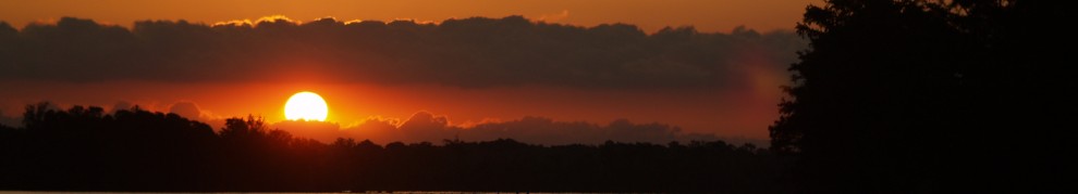
Each morning I take a look at the weather to see what’s on the horizon for the next few days. On Monday morning in Beaufort NC, I was reading a tropical weather forecast from Chris Parker, the weather router that we are working with on this trip, and saw that he perceived a possible threat from an intensifying weather system that might threaten the East Coast, and us, in the coming week.
Based on this I decided to talk to him on the sideband radio when he was giving his morning weather briefing. Chris’s routine is that he talks about the weather and then boats that subscribe to his service can ask questions. I had two questions for him. One, would he advise that we stay in Beaufort for a few days or would it be better to head south with the hope of getting out of the way of the storm as it tracked northward by the weekend. Second, what was the wind forecast for making a run from Beaufort NC to Charleston SC, a 210 km trip that would involve an overnight run.
First, Chris felt that there is a 20-30% chance that the storm will head up the Eastern Seaboard and perhaps make landfall in the Chesapeake. Most models have the storm heading out to see and going over Bermuda by the weekend.
He also felt that we could get some good sailing in by heading offshore for our run south. Having said that, Chris also said that while the winds were good on Monday, they would likely decrease as our trip wore on. Hmm… What’s a sailor to do? Offshore sure sounded great to me but I wasn’t too keen on motoring half of the way if the wind pooped out. Also, many folks we talked to had recommended that we do the ICW run to Charleston at least once as it’s a lot of fun and there is so much to see along the way. Also, we will have to run outside from Charleston to bypass Georgia as there are so many areas there that have shoaled in that making the run in Pandora, with nearly 6′ of draft, would be challenging. The jist of this meant that if we were to run outside to Charleston and then again south from there, we would miss much of the ICW fun.
Also, there was that niggling issue of Brenda’s concern about going out overnight, something that she has not yet done. Actually, with all of the “normal” women we have met telling her that it’s not bad and actually fun to sail at night, Brenda is beginning to come around to the idea. However, it’s clear to me that she’s not there quite yet.
So, what to do? Well, by the time we had the information from Chris it was mid morning and the day was getting away from us. The problem was that each hour that we delayed in getting on our way made it more likely that we would arrive in Charleston in the dark, something that I didn’t particularly want to do.
So,we headed to the fuel dock to fill up on fuel and water ($4.15 a gallon, thank you!) and headed out of the harbor. As we headed out into the channel we were still reviewing our options and as we got to the “decision point” where we had to turn right and head down the ICW or head out to make the run offshore. What did we do?
Inside? Outside? Inside? Outside? Much discussion….. Well, we decided to take the scenic route and go down the ICW. Me? I’d have preferred to do some sailing as I fear that I may have forgotten how to take off the sail cover in the weeks since we have actually sailed. However, given the diminishing winds and the possible night landfall, perhaps inside was best.
So, where’s Pandora and what’s this thing about the Army? (Don’t forget to visit the “Where’s Pandora” button on the home page of my site.) Given our somewhat late start, a logical place to go was a neat anchorage maintained by the Army within Camp Lejeune. So, we decided to “join” the Marines in their anchorage.
As we headed down the ditch, I have to say that it is very pretty even if we were motoring. The water on each side of the channel is very shallow, usually only a few feet deep so you have to stay watchful and stay in the channel. It’s also fun as the bouys don’t always match what’s on the chart. The charts on my plotter are a few years old but those on my computer and my paper charts are new this year. There were still differences in some channels where there is a good amount of current moving sand around.
We did find our way fairly well most of the time but we did get a bit confused at one point and ran hard into a sandbank at nearly 7kts. I expect that a good part of the reason for our error was because we were distracted by a dolphin swimming so close to the boat that the spray from his/her blowhole was getting into the cockpit. That distraction (yes, I’ll blame it on Flipper) caused us to take a small mark the wrong way and oops, we came to a crashing stop. Me? I was on deck trying to take a photo of our visitor and when we came to a shuddering stop I nearly lost my footing. Alas, I was able to stay aboard. Whew! It would have been doubly frustrating had I fallen over and broken my leg on the sandbank.
Dolphins visited us often, especially near the inlets and at one point I was down below and watched Brenda as she lurched from one side of the boat to the other, camera in hand trying to get the perfect shot, or any shot that actually showed a dolphin instead of bubbles. Alas, she was always a bit late to get any pictures.
So, what about dolphin photos already? This is about the best example. Perhaps a video camera would work better. Not sure who was more fun to watch, the dolphin or Brenda. Her antics were very cute. The foam in the foreground? That was where the dolphin was a mere second before she took this photo.  As we approached Camp Lejeune we saw a good deal of aircraft activity, particularly the always controversial Boeing Ospreys. These planes (or are they helicopters?) are amazing to watch. They take off like a helicopter and fly like a plane. Two flew by us several times but not close enough for a good shot.
Lest you forget that you are visiting Army land, this was a somewhat unsettling sign. Along the bank there were also sand and cement ramps that I was told were for hovercraft to enter and leave the swamp. I wished that we had seen one of those.
 The swamp land surrounding the ICW in this part of NC is very flat with marshes in all directions. Some parts are completely flat with nothing but marsh grass. It’s very serene.
  The trees look more like they have been affected by the wind than up north. This shot shows it well. Almost looks African.
  Wildlife, birds at least, are everywhere. No more bald eagles but plenty of herons and egrets. Not a great shot but this heron was very pretty. We also saw our first ibis or actually, our first ibisses (is that plural for ibis?). Not sure that this link is the actual type of ibis but you get the idea, curved beak and all. No ibis photos of our own just yet.
  Today we head to Wrightsville Beach and will once again enjoy going under and through a number of bridges along the way. As I finish this up we have already run aground twice (yes, we got off) and have adjusted out speed to deal with once an hour bridge openings that we were way too early for. I’ll have to work on that.