It’s Monday afternoon and we are anchored near Savannah and enjoying a rainy (chilly) afternoon “nesting” aboard Pandora. It has taken us three days to make it here from the most northern part of Florida and even though we have only traversed a little over 80 miles from Amelia Island, our last stop in FL, we have wound around a total of 128 miles through the water. Now that’s a lot of meandering.
There is just no way to go from there to here in even close to a straight line. And, unless you are willing to do an overnight run in the ocean, you just have to motor the entire way inside. However, Brenda doesn’t particularly like the “overnight thing” and besides, the winds this early in the season are pretty much out of the north so inside we went. Had we waited for favorable winds, we’d still be in FL as they aren’t forecasted to arrive for nearly a week from now. Later in the season, when we are well into spring, north will give way to more helpful southerly. Alas, with the “We have to be in New Bern” itinerary, inside it is.
I will say that the view of the marshes along the way is beautiful.
This shot of the plotter gives you an idea of the meandering track I am talking about. To do this run without good charts would be very tough as it would be very easy to loose track of where you are. You can see the icon of Pandora in the lower center of the plotter. That’s us making our way through the maze of channels.  The Georgia stretch of the ICW has a reputation of being among the most difficult part of the waterway to manage if you have draft of more than a few feet as there is just so much shoaling. However, it’s not as bad as you’d think as long as you are willing to time your trip so that high tide is in the middle of the day. That’s because the tide range here is nearly 9’ , the highest of any part of the waterway. So, if you can wait a week, from when low tide is mid day util it’s high mid day, you can make the run in water that’s quite deep.
So, if you can get going at the beginning of a rising tide you will have enough water for much of the day. Besides, a good part of the GA ICW is quite deep, sometimes more than 20’, even at low tide. So, what gives the area such a bad rap?
It actually gets down to only two areas, one called Mud Creek and the other Hell Gate. Both of these areas, and they aren’t all that long, at a few hundred yards each, only have about 3’ of water at low tide so that stops most boats when the tide is low. So, the strategy is to make your way to each of these areas and then anchor nearby and leave the next morning on a rising tide. Fortunately, for sailboats, these two trouble spots are about a day’s motoring apart. Pretty convenient, right?
For those who sail in New England, hearing “Hell Gate” conjures up images of the swirling water and fast currents of the East River in NYC where many ships have met their end. However, the GA version of same is a lot different. It’s a short dredged (well sort of dredged) cut between two rivers. The problem with the GA HG is that the currents at both ends, and it’s only a few hundred yards long, are fierce, running about 2.5kts on both the ebb and flood, twice a day.
A dredge that would do an area like Hell Gate, which is very shallow and narrow, would be tiny, dredges, like this one on the St Mary’s river a few days ago, are huge. This one loomed out of the fog at us as we passed the Navy Base. Look how low in the water it is. It was headed out to dump what it had sucked up earlier. The signature on AIS said that it draws 36’ of water. That’s really deep keel. While the current in Hell Gate itself is minimal, the flood running by both ends moves lots of sand into the cut and undoes the work of the dredge in short order. Anyway, both Hell Gate and Mud Creek are areas that cause problems ALL THE TIME and make transiting GA a “pain in the keel”. But wait, there’s more…
In spite of the meandering nature of the area, you also face currents in excess of 2kts most of the time. So, for part of the day you are thankful for the “good current” that helps you zip along at nearly 8kts and then you curse it as your speed over the bottom slows to a crawl at more like 3.5kts when the current is against you. I suppose that it all evens out in the end but somehow the “bad” current always seems to hit late in the day when you are thinking “are we there yet?”
However, now the worst is behind us and tomorrow we will check into a marina, our first on this trip, and spend a few days enjoying historic Savanna.
However, before I break, I’ll include a few photos from our run through GA.
But first, a few more of some of the beautiful homes on Amelia Island. This one is the largest in the historic district. It’s now a B&B. I’d like to have the tower room please. I had to pry Brenda’s fingers off of the porch railing to keep her from checking in. Success!!! This porch is magnificent but it gives me a headache even to think about paying to have it painted.
  Speaking of porches. Brenda loves doorways and here are a few of her favorites. Mine too.


 As we left Amelia Island we passed an unlucky sailboat looking like anything but it’s name “Joy”. We had seen this boat a number of times and were sorry to see her in such an unlucky spot. I expect she dragged her anchor the other night when we experienced really strong winds while we were at Amelia Island. That night we had opted for a mooring as we were concerned about the strong currents and wind causing problems with our anchor. Perhaps the skipper of Joy wishes he’d done the same thing. Perhaps it’s only luck that keeps us from having the same fate.
  After leaving Amelia Island we spent an afternoon walking on Cumberland Island, a national park donated by the Carnegie Family. It’s a beautiful island with many walking trails and spectacular views. The island is covered with ancient live oaks and palms. It’s looks very primeval.
  At the southern end of the island wind-blown dunes dominate the landscape creating an other-worldly view. You can click on this and it will get larger on your screen.
 The island was once owned by the Carnegie family and their grand mansion now stands in ruins. It was once 30,000 sq ft and three stories. It must have been an amazing place to visit. We learned that the estate had a staff of 300 at it’s peak. Imagine the wealth needed to sustain such a lifestyle.
  The trees on the island are huge. This Live Oak dwarfs Brenda sitting on a bench.
 There is much wildlife on the island including wild horses and turkeys. We didn’t see horses on this visit, as we did last time, but we did see turkeys as well as hawks and plenty of other birds.
Speaking of birds, for much of our run over the last two days we were followed by Arctic Terns who have been wintering in the south, like the rest of us other “snow birds”. They followed close behind us and swooped in our wake to catch any fish or shrimp that we stirred up as we passed. Well, we made it through GA, Hell (Gate) and beyond. I am really looking forward to the next few days when we explore old Savannah.
Well, I guess that’s about it for now. It’s after 5:00 and opening time aboard Pandora so I’d better get on with it and publish this post.
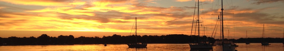
Oh yeah, one last thing. How about a shot of a beautiful sky from the other day? The sun trying it’s best to burn through the haze.  Andn o post is complete without a sunrise, or sunset. How about a sunrise? Well, I think that’s what it was. Not sure…
 Well, it was pretty anyway.