Monthly Archives: May 2020

She hoped for a zephyr. She got a tempest

Well, it’s been over two weeks since my last post and I feel badly about that so let me try to bring things up to date.  Here goes…

First, recall that Brenda and I participated in the Salty Dawg Homeward Bound Flotilla, an effort designed to help nearly 220 boats, stranded in the Caribbean by the Covid-19 virus, return home following the closing of nearly every island.

While some boats in the flotilla opted to take a northerly run directly toward New England, the bulk of the fleet, like us, chose a southerly route, departing from the USVIs, heading west, south of the Bahamas and on to Florida, a mostly down-wind route.

Even now, weeks after our departure, there is still a large flotilla making their way along that same route.  Here’s a screen shot of the group, 65 strong, as of this morning.  
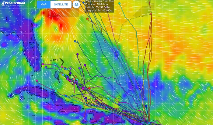
While many cruisers decided to take their boats north, some opted to stay in the Caribbean for the summer and not make the long run to the US.  The decision to stay in the islands was easier said than done with most all of the islands still locked down and closed to new arrivals.  As a result, they were faced with the difficult decision of keeping their boat wherever they were when islands closed their boarders, many deep in the the hurricane belt.

To avoid the risk of hurricanes, Trinidad is the only island generally considered to be safe, but that island is still closed and there is much uncertainty as to when the island will open up again and if they will do so before the hurricane season is in full swing.  At this time there is hope that boats wishing to summer in Trinidad will be able to head there, by mid June, at the earliest.

Additionally, getting insurance for boats summering outside of Trinidad, at an affordable price, or at all, is increasingly difficult due to the back to back destructive hurricanes that ravaged many of the islands.

A friend of ours, with a nearly new 47′ Hanse, is paying a premium of nearly $18k to keep his boat in Antigua where his boat happened to be when everything closed down.  That’s a huge premium with many restrictions and is indicative of the risk that the underwriters see for what is expected to be a particularly active season.

Happily, Pandora is now in the US and as long as I am north of Cape Hatteras by mid July, we will be in good shape.   I’ll be heading back to FL in a few weeks to bring Pandora north for the summer.

I say for the summer as opposed to “forever” as I am still holding out hope that there will be a next winter season of tropical sailing but, frankly, that’s looking increasingly unlikely.  Between the ongoing threat of the virus in the islands and the huge number of cases in the US, I expect that many countries will think twice before they welcome us from the US to visit.

The Prime Minister of Antigua recently stated that they may be forced to keep restrictions in place until a vaccine is available.  Additionally, I am wondering about island to island travel once we are there?   Will it be possible to go down the chain freely without a two week quarantine when transiting between islands?

I wouldn’t blame the local governments if they were concerned about visitors from the US given the fact that with only 4% of the world population we have  a third of the deaths and no national testing and tracking plan to manage things going forward.

And another and certainly the biggest complication in all of this is that Brenda, who was traumatized by how rough it was for the second half of our trip, is not enthusiastic about stepping aboard Pandora again any time soon, and surely not about heading south this fall.

As I mentioned in my last few posts, the first half of our trip was fairly benign, with conditions that were pretty much as ordered, modest winds from behind us and seas that weren’t too bad.  We even spent a few days motoring as the winds just weren’t strong enough to keep moving well.  However after we departed Great Inagua, things deteriorated and were much worse than expected.

For the first few days after leaving Great Inagua, Chris Parker advised us to go slowly, no more than 4.5kts so that when we exited the Old Bahamas Channel it would be late enough to have allowed the forecasted adverse winds in the Gulf Stream off of Florida to have calmed down.    With Pandora on a broad reach in 20kts of wind, keeping her speed down was no easy feat.   Even with a third reef in the main and with the boom centered along with a fully furled jib we were still moving along at a good 6kts which was still way to fast.

All I could think of to slow us down more was to trail a sturdy bucket behind the boat, which finally did the trick.  
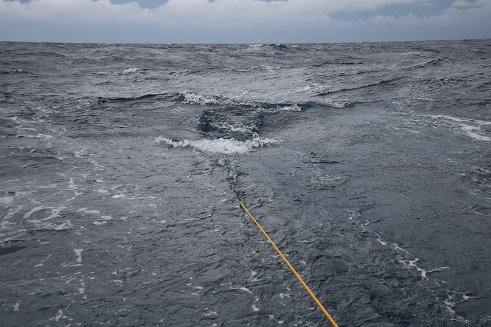
However, just a few hours later, we received another email from Chris telling us to speed up as the forecast had changed and we now had to make landfall in Florida sooner than he had expected in order to avoid a possible tropical low that was developing in the Gulf of Mexico.

So, out came the bucket and let me tell you, retrieving it was no easy task as I had not been able to put a trip line on the bucket and pulling it in was very difficult.   The seas behind us, at that time, were not that large but, never the less, looked ominous.  
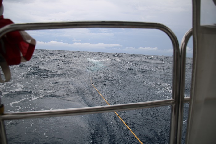
With the forecast changing, Chris advised us to go as fast as we could to avoid getting tangled up in what could be strong NE winds in the Gulf Stream, bringing with it short waves in the 10-12′ range, punishing or worse with wind and current opposing in the stream.

His email stating that there was a change in plans included words of warning, “this is going to be horrible”.   Brenda loved that…

One of the key issues for us in taking the southern route, below the Bahamas in the relatively narrow channel between the banks and the north coasts of the Dominican Republic and Cuba, was to stay out of the shipping lanes and yet not stray into water that abruptly rose from 1,000′ to 20′ or less. These shoal areas are very poorly charted and waves can pile up and break with such an abrupt change in depth.

You can see the shipping channels, west and east, on this chart.   Our plan was to stay just north of the west bound channel so we could be in deep water and still stay out of the way of shipping.   See the “ruler” showing 3.3 miles on the chart to give a feel for scale.    We didn’t want to stray any closer to the banks than a few miles, “just in case”. 
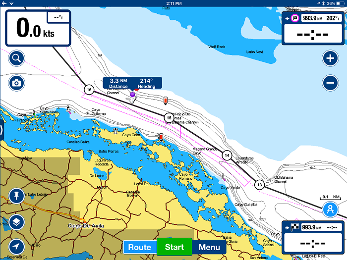
A closer view will give a feel for how close to the shoals the channel was, only a few miles.   However, it seemed to me, as I planned our route, that there was plenty of room to work with. 
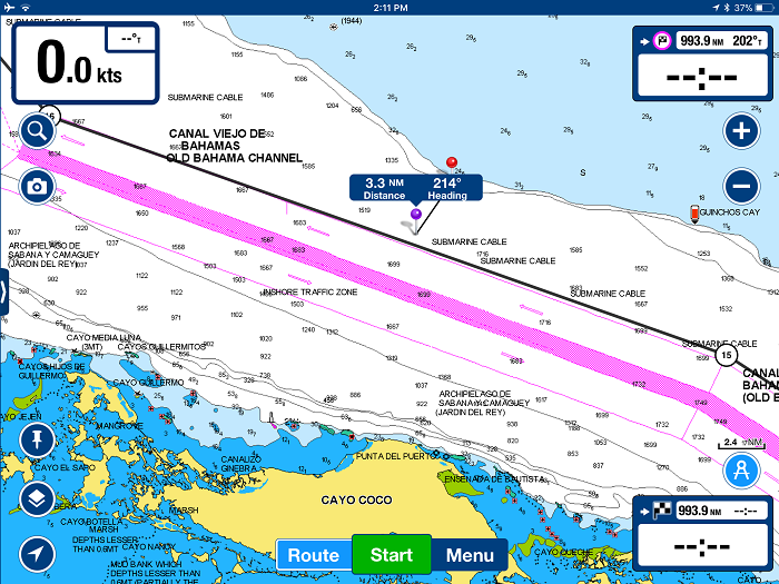
However as made our way through the area and were within a few miles of the shoals, I had serious doubts about my plan as I started to get some odd depth readings on my depth-finder.   And, to make matters worse, it was in the middle of the night with no moon so there was no way to gauge the depth of the water by color.

As I came within a few miles of the shallow area on the chart, I began to see readings on my instruments suggesting that I may have strayed onto the shoals.  I have found that my depth sounder often shows random readings, even when the depths are great, which I assume are schools of fish, temperature gradients, seaweed or other debris that cause the instrument to flash random and very shallow depth readings from time to time.

However, in the dark of night and with little sleep, I really didn’t know what to think.   All I could imagine was that the charts were wrong as I was seeing accurate  readings suggesting depths of less than 20′, and counting down slowly to ten feet and less, only to begin counting back up to deeper readings before loosing depth readings altogether as we headed back off-soundings.  It sure looked to me like a grounding was going to happen at any moment.

Here I was, in the middle of the night, sleep deprived, and I wasn’t sure what to think as I just didn’t know what to make of the readings.  After seeing the depth readings methodically count up to alarmingly shallow depths and then back down, I became convinced that I was going to run aground at any moment.

At one point, after “bracing” for what seemed like an inevitable impact, with readings near the depth of Pandora’s keel, I decided to jibe, turning sharply away from the imagined shoals and back toward the shipping lanes only to see a continuation of unexpected readings.  I really have no idea if I was close to running aground or not but the charts, if they were correct, had me at least several miles away from the shoals.   The good news is that we didn’t run aground but I am still unsure if it was the instruments or if I was really in danger.  I guess I will never know.

The first time I had experienced this was was in 2016 off of the south coast of Cuba, again late at night,  in depths that showed on the chart as nearly 5,000′.  It was totally unnerving then too.  In retrospect, with a mile of water under our keel then, the readings were surely false.

After jibing and back toward and area that I was certain were plenty deep, we raced on to the west and Florida.  As we passed the Cay Sal banks to port, our course turned to the NW and we entered the Santaran Channel.  The wind freshened and squalls increased.  Still double reefed and with a fully furled jib we were now on a beam reach and moving fast.

Pandora, sails really well on a reach in those conditions, a double reefed main and no jib and we were flying along at 8.5 to 9.5 kts, sometimes as fast as 11 kts.  We were regularly hit by squalls with sustained 30 kts.  One squall followed along with us for nearly 8 hours.  That was a wild and wet ride and, as luck would have it, was in the dark with no moon so we couldn’t see what was coming until it hit us, and hit us it did.

Regularly, larger waves would slam into the side of he boat and rush over the deck.  One wave hit so violently we both thought that the vinyl enclosure on the aft of the cockpit had been blown out.  So much water came across the aft area of of the cockpit from the starboard side that we really thought that the enclosure had been breached.    As it was pitch dark at the time, it was difficult to see clearly but what we thought we saw, was quite unnerving.   Later, another wave hit the starboard beam with such a bang that I went below, sure that one of the ports had been breached.

Earlier in the trip, when we were running nearly dead down wind, we were “pooped” several times with waves rising up behind us and slamming violently against the transom.  Fortunately, not much water found its way into the cockpit but it made quite a noise.

A 40′ catamaran that was close behind us, was not so lucky and as a large wave ran up their stern, it flooded over the aft deck, stove in their in their big sliding cabin doors, and soaked their cabin.  They were able to clean things up and keep going but sustained a lot of water damage.

And, a number of other boats, mostly smaller ones under 40′, had boarding stern waves shove water up their exhaust, flooding their engines.  As a result, they  couldn’t get their engines started, unable to find a way to get the water out of their engines while underway.   A water-locked engine can be a common problem when waves hit the transom if there isn’t enough rise in the exhaust from the engine to where it exits the transom.   Unfortunately, salt water left in an engine for several days can be fatal to the engine.

Fortunately, Pandora’s exhaust system exits the transom close to the waterline following a large rise that brings it up under the cockpit and then down low again under the companionway before rising yet again to meet the engine.   Given that final rise to the engine, if water were to find it’s way into the exhaust, it would likely not reach the engine itself.

As I have doggedly pursued leaks aboard Pandora for years now, we had very minimal water below, in spite of the rough conditions, with the exception of a “new” leak around the mast boot on deck which got our custom mattress quite wet.  When we arrived in Ft Pierce I fully rinsed the mattress with fresh water and purchased a dehumidifier and a fan to be sure that it dried out quickly before any mildew set in.  I think it’s fine now but time will tell if it ever feels clammy.  Frankly, I was surprised that we didn’t develop more leaks given the massive amount of water that we took on deck.

Crossing the Gulf Stream, in conditions with about 30kts out of the east turned out to be a lot easier than I had expected except that a particularly persistent squall stayed with us for nearly eight hours, making for a miserable night.  We could see the squall all around us on radar but as we moved toward the NW, we were unable to move away from the rain and wind as it was moving in the same direction as we were, hour after long hour.

But wait, there’s more.  Things finally quieted down as we passed Miami but as we approached Ft Lauderdale, an hour before daybreak, we were hit by yet another nasty squall, just as we approached the sea buoy at the end of the channel.

Conditions were quite rough and as I dropped the main, the boom dropped lower than normal and nearly slammed into the top of the hard dodger.  Normally, the hydraulic vang holds the boom up but somehow some of the pressure had leaked out and it drooped down more than it should have.

I thought that the topping lift line was up enough but it wasn’t and the boom nearly crashed violently into the top of the dodger as the boat rocked from side to side in the swell.  After a few alarming moments as the 20′ boom slammed from side to side, I was able to secure an out-haul to stabilize it but working my way up onto the deck as the boat rocked violently was not fun especially after two days and nights with little sleep.

It’s safe to say that all of this was not amusing to Brenda but we made it and finally passed the breakwaters and entered calm waters.  We were back in the US.

When Brenda and I had been discussing the best options for getting us and Pandora home, we decided that her getting on a plane with the risk of contracting the virus so she reluctantly decided to make the run back to the US with me in what would be the longest run for her to date, some 1,500 miles, beginning in St Lucia, all the way to the US.

While the final run from the USVIs to FL was only about 1,100 miles, it was still nearly three times longer than her longest run to date and along the way the only option to stop and rest was Great Inagua, an unpleasant and exposed anchorage, with every other port closed and off limits, if things deteriorated.

So now, with Pandora back in the US, even if it’s only Florida, it’s looking very iffy that I’ll be getting Brenda back aboard any time soon.

Brenda wanted the run home to be a “zepher” but it turned out to be more like a “tempest”.

I guess time will tell with what the next chapter will look like for me, Brenda and Pandora.  For now, I’ll just focus on getting Pandora north and as Scarlet O’Hara once famously said.

“I won’t thing about that today, I’ll think about that tomorrow.”

On the home stretch, we think.

It’s Tuesday morning and I just shut down the motor that has kept Pandora moving since we left Great Inagua at 15:00 yesterday.  We are currently about 50 miles north of Cuba and making our way west toward the Old Bahamas Channel.  The wind has finally begun to fill in at about 10kts from the NE giving us a nice beam reach sail.  These conditions are expected to continue until tomorrow when the wind should increase 10-20kts, from the same direction.

We spent three days waiting for good weather in Great Inagua and with the exception of a few brief intervals of calm, it was a miserable anchorage, with a steady stream of swells coming around the southern tip of the island, making for very uncomfortable conditions as we rolled violently from side to side, sometimes enough to knock things off of the galley counter into the sink.

On the bright side, the water was impossibly clear and a beautiful shade of blue, a reminder of the past seasons that we have spent in The Bahamas in.   The water in the Caribbean, while nice, is nowhere as clear as it is in The Bahamas.  We were anchored in about 25′ of water and you could see the bottom as clearly as if it was a mere 5 feet deep.  I did go swimming once during our visit and while hanging off of the stern of the boat I could see the anchor chain entering the water and going all the way to the bottom.  I’d guess that you could see between 75′ and 100′ through the water.

As I mentioned in a past post, less than a half mile behind us the 25-35′ depth abruptly dropped off of a cliff to over 1,000′ deep and it was all I could do to keep from looking over my shoulder when I was in the water, imagining a shark lurking up and over the cliff looking for dinner.  Thanks Peter Benchley, you’ve ruined swimming in the ocean for me, forever.

Anyway, the water was a remarkable blue and while I did go swimming, I can’t say that it was relaxing.  Brenda decided to skip it.

Oh yeah, and I did I mention that it was HOT?  Fortunately, there wasn’t much wind as that did keep the wrap-around swell down somewhat but it made for a very hot anchorage.   Additionally, in the evenings, even thought we were hundreds of yards off of the beach, the mosquitoes were terrible.

Each night seemed to be progressively worse and by the third night Brenda and I ended up sitting in the salon swatting mosquitoes, well after midnight, trying to reduce the resident population, at least a little.   We have screens for our hatches but with the very light wind, to close them made it even hotter down below.  Finally, after several hours of swatting, Brenda went back to bed and I sat up alone trying to attract and destroy the rest of the “armada”.    It wasn’t until I had the brilliant idea of lighting a bug coil and placing it in the forward head that the problem was finally solved.   The mosquitoes were still there but somehow, they no longer tried to land on us.  Those coils really worked for us.

Anyway, after that “final” night we swore that we’d not stay for even one more and when you added the boat snapping from side to side, sometimes nearly 20 degrees in each direction, “enough was enough”.

Sympathetic cruisers who were in contact with us suggested that we put out a bridle on the anchor chain to the stern of Pandora to pull her more in line with the waves.  That would normally be a solution but with the light and variable wind, constantly changing direction, that was unworkable.

Chris Parker was advising us to stay there for another day but we just could not stand the thought  of another night at anchor 4-5kts and leave earlier.  The idea being that we would not get to the Gulf Stream until the adverse winds cleared out.   So, we left early but have to go slower.    With that in mind, we are trying to keep our speed down by going under main alone.  I expect that I will need to put in a reef soon, as well.  Making Pandora go slower goes completely against my instinct but, in this case, it’s what we need to do.

A friend of mine, Tom on Aladdin, is a day ahead of us and will be right in the middle of the nasty winds in the Gulf Stream so let that be a lesson to us in keeping Pandora from getting there too soon.

Keeping our speed low is important as we have to be sure that we don’t exit the Old Bahama Channel and Santeren Channel and into the Gulf Stream off of Florida until some bad weather that is forecasted to clear out by sunset on Thursday.

Keeping our speed down will be particularly tough as a NE wind in the 15-20kt range is supposed to arrive here later today and we will need to reduce sail to keep our speed down.   Hopefully, when I speak with Chris Parker this evening, he will say that conditions in the Gulf Stream will clear up a bit sooner than he had anticipated so we can keep moving.

When I say “clear up” I am referring to strong those strong NE winds in the 25+ range that will be in the Gulf Stream later in the week, and anytime that the wind in the Stream opposes the northbound current, you get really steep waves that are very close together.  In this case, they would be 10′-12′ steep waves, really miserable conditions and something that we really need to avoid.

Oh yeah, speaking of seasickness, Brenda has adapted to life at sea, a first for her.   She is eating well, knitting and reading and has also been able to stand watch both at night and during the day.

She is even able to move around down below, something that is normally not possible for her.  I will stop short of saying that she’s “having a ball” but at least she doesn’t feel sick all the time.  That’s good and is making a long trip more bearable for us both.

We are staying pretty loose on keeping watch while underway and it seems to be working out well for her to sleep down below until about midnight and then to stand watch for several hours while I catch some sleep myself.  It’s an informal plan and is working well for us both.

So, here we are on the “final stretch”, sort of, of a 1,500+ journey that began back some two months ago in St Lucia when the Covid-19 virus began to wreak havoc around the world.

I’ll admit that we are both anxious about re-entering the US given the fact that our home country seems to be really struggling to keep things from spiraling out of control.

So, with some luck, any changes in the weather forecast will be for the better and we will still arrive in Ft Pierce by late Friday or perhaps Saturday.  Of course, that assumes that we don’t have to divert to Key Largo or perhaps Miami to wait out adverse weather.

Wish us luck.

Half way home. Sheltering in Great Inagua.

It’s Saturday morning and here we sit, at anchor, in Great Inagua, the most southern island in the Bahamas where we will “shelter” until the coast is clear to make our way to Florida and the second half of our journey as part of the Salty Dawg Homeward Bound Flotilla.  We are one of over 200 boats that are taking advantage of the support of this wonderful group.

I should note that I am a proud member of the SDSA board of directors and am thrilled with what all the volunteers are doing to support cruisers making their way home during this difficult time.   Up until only a few days ago, even being able to stop and rest here was forbidden and is only now available to us, in part, as a result of the hard work by SDSA volunteers and their work with the Government of The Bahamas on our behalf.

The sunrise as we approached Great Inagua yesterday morning was spectacular. When we first arrived, along with another 7 flotilla boats, we had a welcome sight, a USCG chopper paid us a visit. 
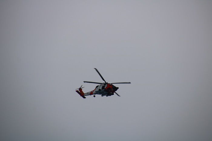
The USCG is always really supportive of the Salty Dawgs and carefully track the movement of the fleet each year.

It was a welcome sight to spy land for the first time since leaving the USVIs.  Not much to look at, I’ll admit. 
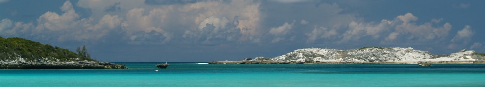
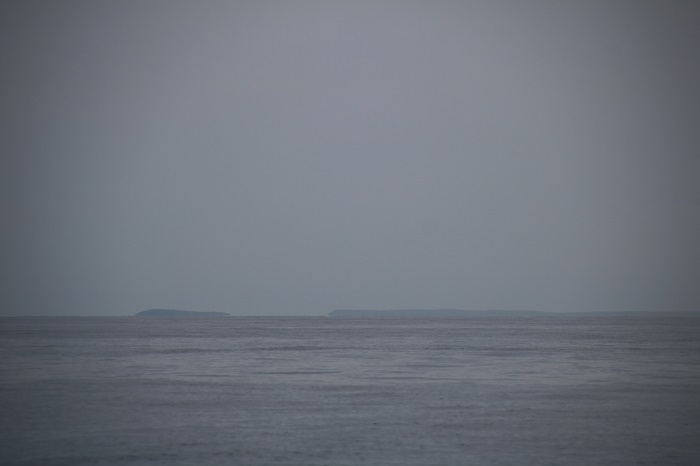
As we rounded the western point of Great Inagua, one of the very few lighthouses anywhere in the Bahamas.  
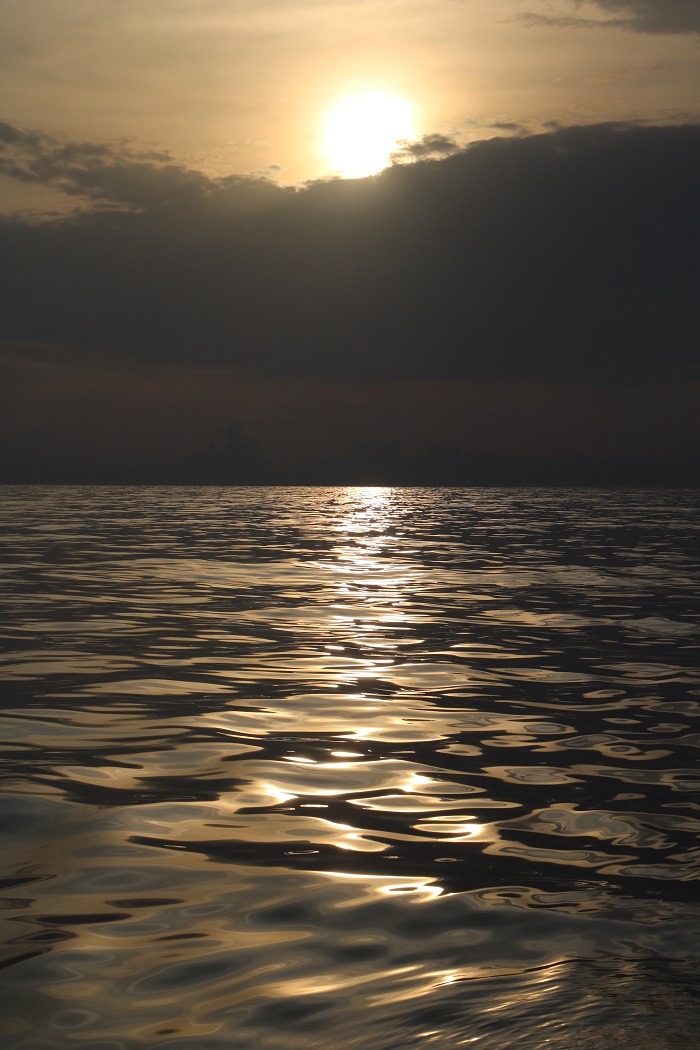
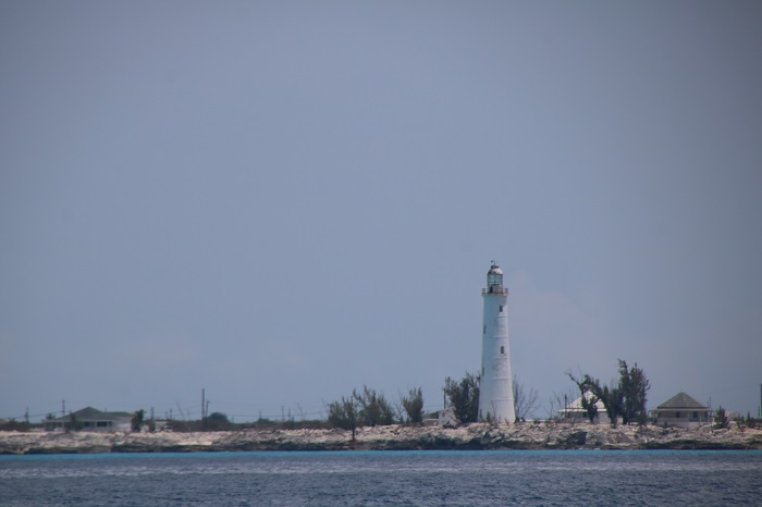
Along the way here, we saw some spectacular sunsets.  
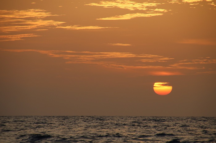
And the setting full moon. 
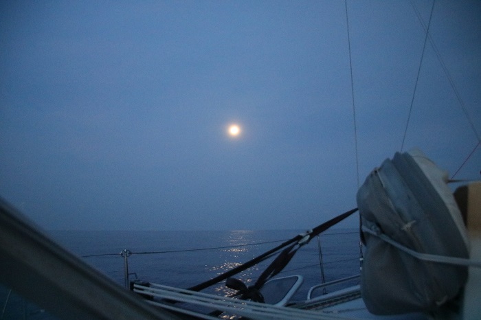
And a day that had so little wind and calm seas that it might have been a sunrise  in August on Long Island Sound. 
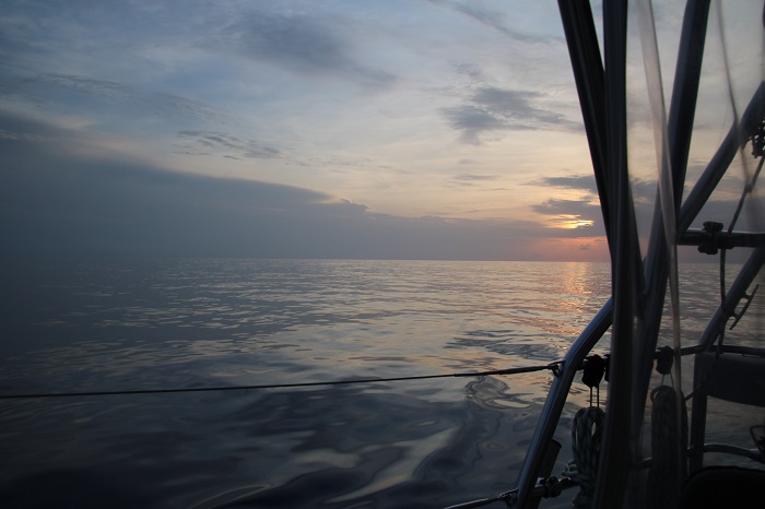
Brenda and I are thankful for the many notes of encouragement congratulating us on being able to rest for a few days before heading out again.    Let me temper the thought of “resting” as the anchorage is remarkably rolly with the wrap around swell from the ocean.  And, with little wind, it’s oppressively hot and sticky.

As this chartlet shows, this is hardly a harbor, as we are basically resting in the lee of the island with the wind coming, more or less, from the east.  That’s Pandora, the red triangle to the left of the island.  BTW, the east in this chart is to the right.  As you can see, not much protection at all.  
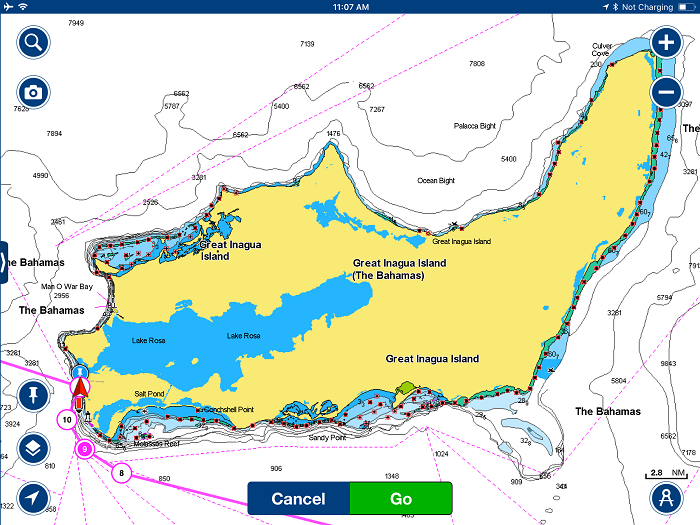
The swell that’s coming around the point isn’t particularly large but as it’s hitting us on the beam, causing us to snap-roll, up to as much as 15-20 degrees in each direction, sometimes violently enough to dislodge everything on the counter in the galley.  Last night, horrors, my stemless wineglass went flying on the chart table, with the contents of the “full” glass draining down into where the charts are stored.  The ensuring mess paled when compared to the terrible waste of wine.

And later, as I was pulling a package of meatballs from the freezer for dinner, they spilled back down into the freezer.  Fortunately, as Brenda made them herself, she knew exactly how many there were so I could confirm when I had collected every last one from the depths of the freezer.

Also, a bit unnerving is that we are anchored so close to a “cliff” where the water depth drops from the 20′ that we are anchored in to depths of 1,000′ and more, only a mere half mile away, as shown by the “ruler” on this chart. 
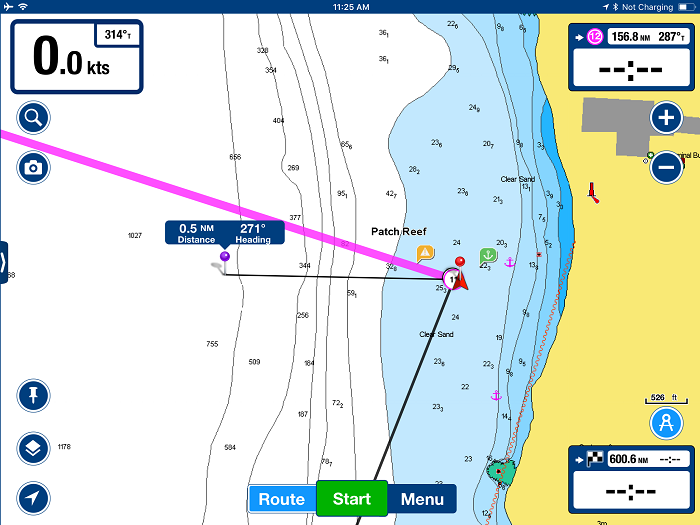
I thought that it would perhaps be helpful to provide some context on where we are, waiting for Chris Parker to give us the “all clear” to get underway again. BTW, that’s likely to be Monday a few days from now.

Our arrival in Great Inagua marks the successful completion of the first half of our voyage, with 550 miles of the 1,100 to Florida, now under our keel.  You can see the route in it’s entirety below.  Again, we are the red triangle.  Note that we are just north of the Windward Passage, marking the separation of Cuba and Haiti, the passage that Brenda and I took to get to Santiago de Cuba when we landed there from the Bahamas back in 2016. 
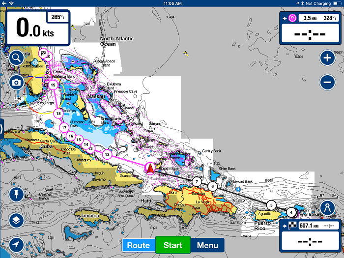
The remaining distance between us and Ft Pierce, where we will make landfall late next week, still seems like a long way off, and it is.   The run will take us west through the Old Bahama Channel, waypoints 13-16, and the Santarin Channel, waypoints 16-18 and then the rest of the way up to Ft Pierce.  The northward current in the GulfStreem will provide a boost of several knots,  as we make our way north the final 200 miles to our destination. 
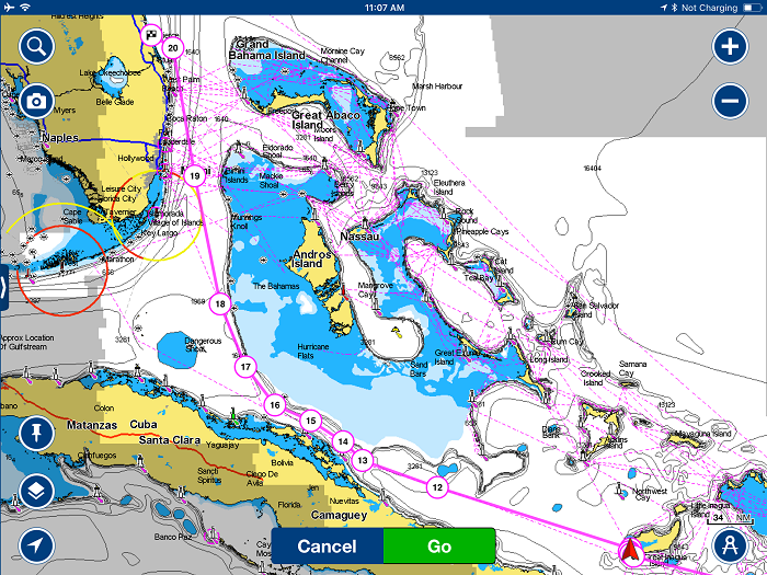
Of course, being in Florida will not really be “home” as we will still have to drive the rest of the way to CT.  Our plan, once on land, is to leave Pandora in Ft Pierce and rent a car to make the run home non-stop, with me and Brenda sharing the driving, or should I say “standing watch”.  Oh boy, what we wouldn’t do to have a self driving car waiting for us.  I’ll return to retrieve Pandora in a few weeks with crew for the run to CT, as I have until mid July to have Pandora north of 35 degrees, or Cape Hatteras.

So, here we sit, waiting for the all-clear from Chris to get underway again.

I thought that I’d provide a look at his forecast for the rest of the trip, with some thoughts on what it should mean for us.  Of course, the last few days days of the forecast, in particular, are a long way off so they may very well change.  But, for the moment, it appears that the really nasty weather, that’s hitting the waters of Florida and the northern Bahamas over the weekend, should be history when we are making our run back to the US.

We expect to depart on Monday, the exact time subject to a revised forecast by Chris.  Here is Chris’s forecast as of today with his assumptions on how things will look each day as we make our way to Florida.

Chris:  During Monday the 11th daytime and nighttime: The wind will be variable at 0-15kts from a variety of directions.  You will be motoring.

Bob:  That’s good as it will be fairly calm and while we have motored a good amount already, we still have plenty of fuel left.

Chris;  On Tuesday the 12th all day and into the evening, the wind will be from the NE to ENE, building from 10k to 15k, with sailing on a beam reach.

Bob:  At that point, we should be near waypoint #12, north of Cuba. That should be good sailing as Pandora performs well with full main and jib in those conditions.  The seas should be reasonable and our speed, in the 6-8kt range.

Chris:  On Wednesday the 13th, the wind will be ENE at 15 with gusts to 20, ideal for beam reach sailing. 

Bob: At that point we will be in the Old Bahama Channel, a narrow waterway north of Cuba.  The conditions Chris describes sound pretty good, with the wind hitting the boat directly on the starboard beam, a comfortable point of sail and at those wind speeds, with little heeling, probably about 12 degrees.

Chris; On Thursday the 14th, wind will be from the east at 20, with gusts to 25 in GulfStream, sailing on a beam to broad reach.

Bob:  By then we will be off the coast of Florida and moving north.  With wind at 20 with gusts to 25 the sailing will be “sporty” but with a reef in the main, we should be OK.  At those wind speeds, and wind aft of the beam, but not too deep on the wind, Pandora should be hitting 8 to as much as 10 kts through the water helped along by the current of the Gulf Stream, giving us speed over the bottom of 10-14kts over the bottom.  This will, I hope, be very fast sailing.

Brenda:  “Fast sailing perhaps, but that day will pretty bumpy, or should I say shitty!  Just sayin…

Chris:  On Friday, heading north with the GulfStream from Miami-FtPierce, the wind veers from E to ESE or SE at 15-20 with gusts to 25.   And there may be a few mild squalls with up to 30kts of wind at any time between the Old Bahama Channel north to Ft Pierce.

Brenda:  “Shit, Shit, Shit.”

So, there you have it, here we are, sheltering in Great Inagua, waiting for the dust to settle along the path between us and Florida.  At least we can have a glass of wine in the evenings and not worry too much about the weather.   Of course, with all the rolling, we will have to hold on tight to our glasses.

While this post is, and nearly always is, “all about us”, there are a lot of other boats making the same journey now and in the next few weeks, with the next group heading out in the next few days.  This is a screen shot of the tracker as of Saturday morning.  That’s a lot of boats are underway.  You can see this tracker in real time, for yourself as the upcoming days unfold by following this link.

One more thing…  Sunday is Mother’s day and Brenda is none to happy about spending it here, having to clutch that celebratory wine glass tightly to keep it from spilling.

At least we have excellent cell coverage here so our son’s Rob and Chris will be able to talk to their mother.

And I know that they will, as they always are, very attentive to their mother.  They are very good boys!

Wish us luck.  500 miles to go to the US.


Settling into a routine at sea

We are approaching the western end of the Dominican Republic, Haiti.  We have been at sea now for three days as of 13:00, begin our fourth day at sea.  With 400 miles under our keel we are about 150 miles from the halfway point of our voyage to Florida.

Brenda feels fine with no particular sign of seasickness.  Yes, it’s been quite calm, but she is better on this trip than I have ever seen her, ever.

For me, now three days into the trip, I am settled in and am not all that focused on how long a trip this will be.  I do find that it is the second day that is the toughest, as I am not into the routine, and much of the rest of the trip is still ahead of me.  WE ARE GOING TO BE AT SEA FOR HOW LONG?

As good weather forecasts are not possible beyond about 5-6 days, and that often proves to be wishful thinking, we are now at a point in the trip where whatever was predicted when we left the USVIs is now “subject to change” and that is exactly what is happening now.

A low pressure system, at first feared to become an early season tropical low, is forming in the Gulf of Mexico and will surge to the NE over the weekend, crossing Florida and the waters of the Gulf Stream and Bahamas, bringing strong north winds and intense thunderstorms to the area at just the time we would be arriving in Florida waters which is not good.

As our trajectory would bring us to that area just as things get really bad, we have had to make other plans.  For just about every trip I have made, the second half of the trip, and often just a few days after leaving port, turn out being a lot different than forecasted and this trip is no different.

What has caused things to be so difficult for cruisers this spring is the fact that convenient stopping points are closed and once at sea, there just isn’t anywhere to stop along the way when the weather gets bad.

As part of the Salty Dawg Homeward Bound Flotilla, a representative of the group has been in touch with the Bahamian government with the hope of offering support for cruisers that need to stop and rest of make repairs, something that was forbidden in the country as a result of Covid-19.

A tiny door was opened last week when the government of The Bahamas agreed to allow cruisers to stop at a number of designated marinas with the plan of taking on fuel and staying for a single night.

That was a good first step but problem with a plan like that is the nature of the Bahamas as a cruising area, with many complicated cuts and islands that are really only transited during daylight hours so even their offer to stop once, just wasn’t realistic.  To cross the Bahamas safely takes a few days, with stops each night.  And, if you toss in passing fronts, a single night in a marina just isn’t helpful.

So, back to that nasty low that we will collide with if we don’t divert somewhere to wait a few days while the weather sorts itself out.  As we make our way west, we pass a number of great harbors in the DR and Cuba, all of which remain closed to cruisers.

One Bahamian island that we will pass very close to is Great Inagua, the most southern island in the chain.  It is not often frequented by cruisers because of it’s remoteness and exposed anchorages.  The island is low, very arid and has little tourism.  In fact, the largest industry on the island is the Morton Salt Company that collects sea salt in shallow ponds that cover many square miles on the island.   Seawater is pumped into the ponds and the sun evaporates the water leaving abundant salt that is scraped up and packaged for sale.

Anyway, the last time Brenda and I passed Great Inaqua was on our way south to Cuba and while we were going to stop and anchor to break up the trip from Georgetown Bahamas, we opted to keep going because of weather.  So, here we are years later, planning to stop and this time, for weather as well.  I expect that we will have to stay there through the weekend and perhaps leave on Tuesday, maybe Monday to continue our trip to Florida.

I am not particularly keen on stopping for a few days as the harbor can be rolly when the wind is from any sort of northerly direction which it will be for a day or so before we arrive tomorrow, Friday, afternoon.

By the time we drop anchor, we will have covered half of the distance to Florida and it will be time for a rest.   While the govt has agreed that we can stop there, and for more than a single day, we will not be permitted ashore and will be confined to Pandora.  As I understand it, we will not need to clear in and should just fly our Quarantine “Q” flag. That’s fine with me as I no more want to be exposed to the locals than they to me.

On another subject, I have used the phrase “cruising is boat repair in exotic places” over the years and today was no different.  Earlier this morning, as the overnight wind began to die, I started up the engine to get moving and to charge the batteries, that were low after a night running all the instruments and refrigeration.   Pandora has a particularly large alternator designed to provide rapid charging to her large 1,000 AH battery bank.  This alternator, unlike on most boats, is mounted separately from the engine and is powered by a power take-off that runs from a shaft out of the front of the engine.  That shaft turns a large pulley that has two belts connecting to the alternator itself.   I had noticed that the belts were squealing a bit when a peak, near 200A load was put on the alternator and had made a mental note to replace them.  Well today, one of the belts broke and the second was slipping like mad and making a loud squealing sound. Immediately, I knew what had happened but did wonder if perhaps it was a bearing on the alternator.  I turned off the engine immediately and took a look.  It was the belt fortunately, the alternator was fine.

Fortunately, I carry spares for the belts and knew exactly what to do.   However, getting the remaining belt off and loosening the bolts holding the belts in tension in a very hot engine compartment turned out to be quite a sweaty chore.  When the belts slipped and ultimately broke, the friction of the slipping belts on the pulley had made it so hot that even a light touch left a burn.   Working around the hot pulleys was quite a chore, and left me with a few small burns from even the lightest touch.

It took some doing and about two hours, but I was able to replace the belts and get things running again.  Oh boy, was I glad that I had the spare belts.  For the record, I had checked before leaving the US last fall to confirm that the belts in the parts bin were the correct size.  I also have a spare alternator, just in case.

So, here we are, motoring slowly along with about 1.5kts of wind on an oily calm sea and a lazy 2′ swell from the east, with about 130 miles to go until we make our unplanned landfall.

Next stop?  Forget Florida, make that Great Inagua.   Wouldn’t you know it, we finally settle into life at sea and we have to stop?

Let’s hope the locals re friendly.

Day three. Ok and slow…

Day three and we are moving along slowly.

It’s Wednesday afternoon, day three of our passage and we have covered about 300 miles, a little more than a quarter of the trip.   There has been a decent amount of wind so we have only run the motor for about 12 hours so far, not a lot for a trip like this.

The problem though has been the wind direction, directly astern.   This means that we have had to watch the sails very carefully to be sure that we don’t have a crash jibe, which can break stuff.  And that’s not something that we really want to do in the middle of the ocean.

As I mentioned yesterday, it’s really deep here and I’ll admit that it is pretty creepy to see depths on the charts showing that the water is some 5 miles deep.  I suppose that anything more than 100 feet is deep enough but the thought of such crushing depths in absolute darkness gives one pause for thought.

As I write this we are passing The Dominican Republic, one of the largest islands, at over 300 miles long, in the Greater Antilles.   It is very unfortunate that we cannot stop to rest as it would be a very nice way  to break up the trip.   The harbor in particular that I have heard about is Luperon, which is supposed to be very pretty.  Alas, like everywhere else, the island is closed to visitors.

In spite of the trip covering some very large bodies of water, It does feel a bit like I am threading the needle as we have to be careful to avoid some shallow places that are quite large and unmarked by any land mass.   In particular, these areas, like the Bahamas Banks, come very near the surface immediately adjacent to waters that are over a mile deep.

There are two particular areas that I need to avoid, Navidad Bank and Silver Bank both off of the north coast of The Dominican Republic.   While they are separated by 30 or more miles from the DR,  these banks rise steeply from more than a mile deep to within 100 feet of the surface.  This can cause violent waves and as they are not well charted, potential hazards that are more shallow than the charts suggest.   The key is to pass close to the banks in order to stay well clear of the north coast of the DR, the idea being that we want to be out of the wind shadow of the big island.

After the DR, we will pass north of Cuba and below the southern part of the Bahamas a vast area of thousands of square miles of shoals that are less than 15 feet deep.    This passage will bring us within the territorial waters of both countries.  It is a very busy stretch of water and is only about 10 miles wide.   And, to make matters more exciting, it is among the busiest areas for shipping in the world.   This area, like most very busy shipping channels is marked with “fairways” clearly stating which side of the “road” ships should take, north being to transit west and south to east.   Our plan will be to stay to the north side heading west.    The last time Brenda and I passed that area was when we took Pandora from Georgetown Bahamas to Santiago de Cuba.   We crossed the shipping lanes and transited the Windward Passage before heading west along the south coast of Cuba and past Guantanamo bay.

Brenda continues to do well, better than we were expecting.  While she spends much of her time in the cockpit, she is sleeping well down in the main cabin.   She even took a shower in the cockpit today, something that is a daily ritual for me when I am on passage.   I will say that the one thing I really dislike about passage making is that it’s nearly always too hot.  Pandora’s engine is under the galley and when it’s running the whole main salon is warm.  Fans help but it’s sill uncomfortably as all the hatches need to be firmly closed to avoid unexpected waves.   However, as this trip is down wind much of the way, ocean spray is less of an issue so at least one hatch is left open much of the time.

One of the most unpleasant parts of being on the water 24/7 and underway is squalls.  While those here in the tropics are generally pretty mild, with extra wind in the 10kt range, they can still crop up most any time overnight and it can be quite unsettling to be struck by drenching rain and wind from most any direction, with little warning.   And, as these “cells” are on the move, if you happen to be going the same way that they are, you can find yourself stuck under your own private raincloud for hours at a time.

On a passage south a few years ago, I counted nearly 20 squalls that we endured over a short few day period.

Last night was not great fun as around 04:00 we were struck by a nasty cell that stayed with us for several hours.  I finally jibed to try and run away from it but somehow it just moved along with me and hit me all over again.  The winds were not huge but strong enough to make it uncomfortable and not knowing which way the wind was going to come from in the pitch dark kept me on my toes.

After squalls pass,  the wind is often very light and while I was racing along on a beam reach in rough seas just a few hours ago, I am now motoring directly downwind in less than 10kts on a smooth sea.

I am mindful of the amount of motoring that we can afford to do as there will be several days on this trip when we will have little or no wind.  I carry a fair amount of fuel but am limited to about 130 hours of motoring, not as much as I fear might be required foe a downwind trip of more that will likely take more than a week.

When we left St John, we were pretty sure that we would be dodging some nasty weather as we approached the Florida coast and that may have been confirmed today by Chris Parker.  He is concerned that an early season tropical low will be forming in the western Gulf of Mexico, GOMEX, and will possibly move to the NE and impact areas of the Bahamas and southern Florida.  It should not become a hurricane but it may very well become quite nasty with powerful thunderstorms and squalls.

It is very important that we not find ourselves in the area of this low as it would be quite uncomfortable and possibly quite dangerous.  His current recommendation is for us to be prepared to divert to the southern Bahamas, the island of Great Inagua or perhaps the Ragged Islands.  These are not all that far out of our way and are not well protected from nasty weather.  However, they are better than being out in the open ocean during a storm.  Additionally, The Government of the Bahamas has made it clear that they do not want anyone to come into their country.   However, as a participant in the Salty Dawg Flotilla, we have been granted a waiver to stop to shelter if needed.

I did get news earlier today that the restrictions in the Bahamas are still very strict but have been softened a bit to allow us to take shelter nearly anywhere we wish as long as we do not leave the boat.

This is all very unsettling but not unexpected as it is normal to run into adverse weather on a trip of this length.  It is just not possible to get a decent picture of the weather ten days in advance so the unexpected always pops up.  Fortunately, we have options and we will begin to have a better picture of what’s coming over the next few days.

I don’t like running the engine much early in a trip out of fear that we will have a shortage of wind later during the trip and run low on fuel.  However, the forecast still suggests that we should be able to sail a good portion of the trip so I am hopeful that we won’t run out.

So, wish us luck that we will continue to have luck, not too many squalls and God forbid, a storm as we make our way to Florida.

Wish us luck.

Next stop, Florida!

Well, after months of planning, Brenda and I shoved off from the USVIs yesterday to begin or long 1,100 mile run to Florida.  Making such a long run was the LAST thing that Brenda ever imagined she would do and yet, when considering all of the options open to us, she decided that it was the “lesser of all evils”.

To have crew fly in was our first choice but that proved to be much more difficult than we had imagined and with that option, Brenda too would have to spend time in an airport and on a plane, during a time of such danger and uncertainty.   And, crew, not knowing if they were infected along the way, would have to hang out with me in the USVIs for a while to be sure that they were healthy enough to make the trip.  And that would make for a very long time away when you consider that it’s a full week to get home once we shoved off.

Knowing how much Brenda did not want to make the run says a lot about how anxious she has been about flying into the US, with so much uncertainty and potential danger.  She just didn’t feel safe at all and was concerned about the dangers of the virus in large public spaces, airports and aboard planes.   We both feel that things are just not being handled very well in the US when compared to other counties.

So, after months of back and forth, we are making the trip together.

Seasickness has plagued Brenda for as long as we have spent time aboard and even that did not deter her when compared with the possibility of contracting the virus on the way home on a plane.

Over the years, she has tried about everything possible to solve her nausea and on this trip, we decided to give a good try to the “patch”, something that she has used off and on over the years and always giving up due to side effects such as a sore throat.

We also hoped that after a few days into a trip that will surely take more than a week, that her nausea would subside, as it does for most.

So, two days before we were to depart, she put a half patch behind her ear.  Fingers crossed.  So far, it’s working and while she doesn’t feel completely ok, she is able to be down below to sleep, wash up and use the washroom, something that has never been possible in the past.

So, we headed out yesterday afternoon, three hours after I headed ashore to get three more jerry cans to carry extra diesel.   I am really anxious about running out before we get to Florida as the wind is expected to be quite light. However, as luck would have it, the credit card machine in the hardware store was down and I only had enough money to buy one single 5 gallon can.  I thought that I would be able to go to a cash machine but we’ve been away from home for so long that my debit card expired and in spite of being on hold with Bank of America for a half hour, I wasn’t able to connect with anyone to try and get my card reactivated.

And, to make matters worse, after schlepping that one lonely can back to the marina to fill with fuel, I discovered that it had a small crack and it immediately began leaking my precious diesel all over the place.  So, back up the hill to the hardware store, dripping diesel all the way, to transfer the fuel into another can.  I was so frustrated and exhausted.  Up hill both ways, as they say.

Finally, I was able to get it resolved and headed back to Pandora to finish all of the last minute details like hoisting the dink on deck and securing everything for the long run to the US.

So, as I write this, into the second day of our voyage, we are nearing the western end of Puerto Rico and will soon be passing the Dominican Republic, both places that we would normally stop at to break up a trip like this.  Unfortunately, both are fully locked down because of the virus, along with every other island in the Caribbean.

It is interesting to note, that we passed the Puerto Rican Trench, the deepest spot in the entire Atlantic Ocean, over 27,000 ft deep.  There is only one place on the planet that is deeper and that’s in the Pacific, the Marianas Trench, I think.   It’s hard to believe that there is so much water beneath us and that to get to the bottom would involve going down as far as Mt Everest goes up.  And, the crushing pressures are far greater than the dangers of being at the summit of the highest mountain on earth.
I’ll admit that it is a bit creepy to think about how deep it is and at the same time, being out of sight of land for days at a time.

So, that’s our story, we are at sea and while the weather is nice, the wind is directly behind us and is barely strong enough to keep us moving.  Yes, it’s not too rough but Pandora is still doing plenty of bucking around with a following sea and you never know, from hour to hour, if there will be enough wind to keep us moving and how often we will have to run the engine and burn our precious fuel.

We do have enough to run the engine for more than 140 hours but that’s not enough to get us the entire way so we have to be very careful.

For now, we are making the best of it and getting into a routine, standing watch, resting, reading and doing what we can to pass the time as we make our way, non-stop, west to Florida where we will leave Pandora for a month while we head home in a rental car for a much anticipated return to CT and home.

I’ll continue to keep my GPS tracker going to don’t forget to follow us on the Garmin shared page under “where is the world is Pandora” and also through the Salty Dawg Flotilla page. I’ve shared that link in prior posts.

A special thanks to Melody, our son Chris’s partner for putting this up for me.

Stay safe and keep us in your thoughts and prayers.  We need all the help we can get.

Here we are, with nearly 1,000 miles left to go.  Next stop, Florida, sometime next week, I hope.

USA, here we come. Leaving the USVIs on Sunday

It’s been a long journey, getting to a point where we can say “we’re leaving the Caribbean and heading home”.  In a way, it seems like only yesterday when we were in Martinique enjoying the days of Carnival.  So much has changed.

Our plans on departing have changed.  As recently as yesterday Chris Parker, our weather router, suggested that leaving on Tuesday for Florida made the most sense.  However, after speaking to him again today, he has changed his tune and now thinks we should leave on Sunday, the original departure date for the flotilla.

The rub is that I had become focused on a Tuesday departure and am not quite ready.  In particular, I had hoped to purchase a few more diesel cans in town but they won’t be in stock until Monday.  However, fingers crossed, we probably have enough fuel as long as we can sail about half of the distance, so I won’t dwell on that.

However, I do need to fill the jugs that I have on board as I emptied two of them, five gallons each, into one of the tanks today.

So, the fuel dock opens up at 07:30 tomorrow and I’ll head in to fill the cans.  Brenda also wants me to make a last run to the grocery to get some provisions.  A rotisserie chicken will be a good first dinner out.

Next, the dink on board and off we go, hopefully by noon.

However, no post is complete without a picture, or two.  How about some fish?
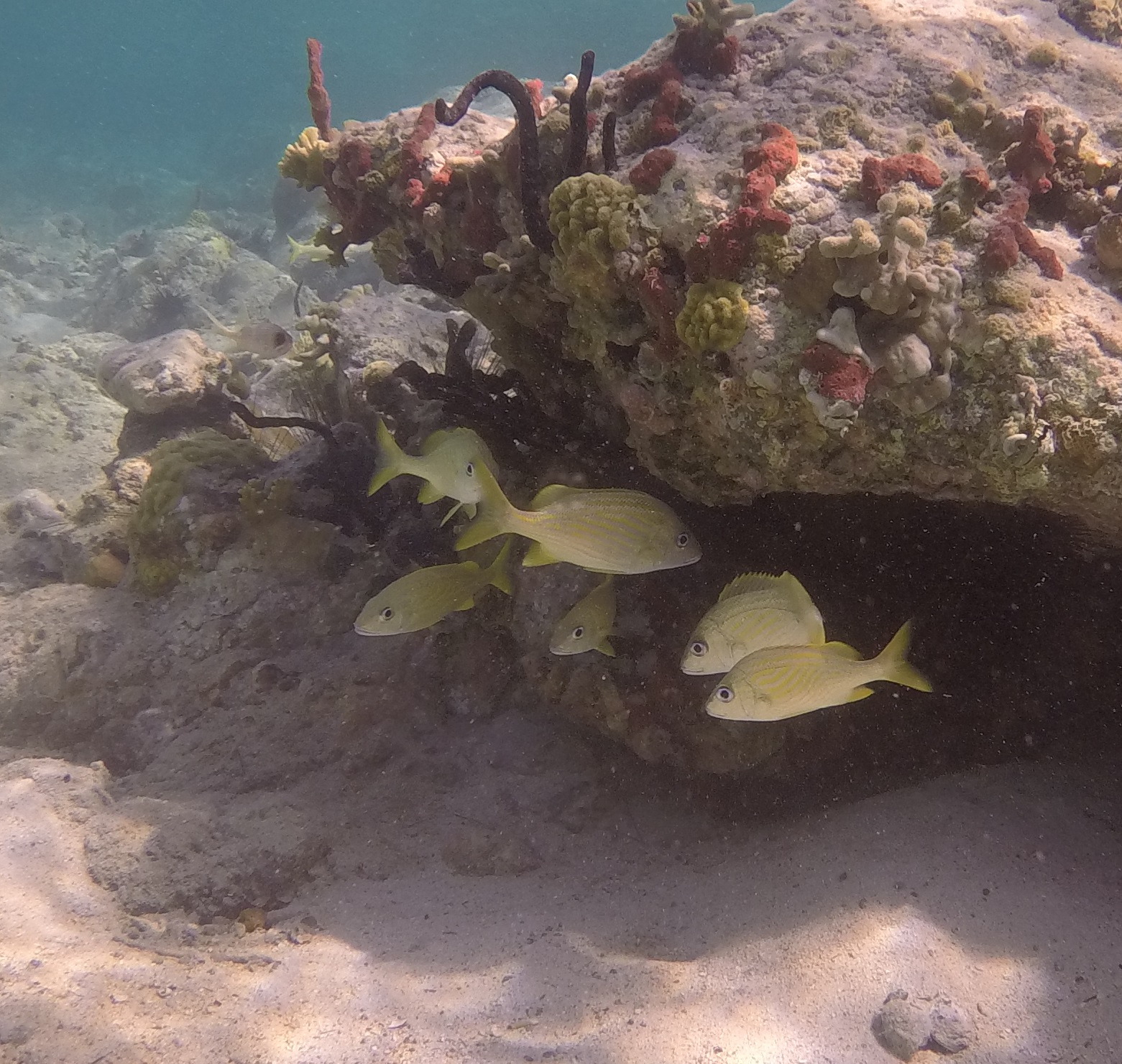
Our son’s partner Melody gave me this great GoPro camera.  I have underwater color correcting filters but they don’t seem to understand the exact color correction needed.  Each filter is coded to depth.  This one was for 5-15’depth.
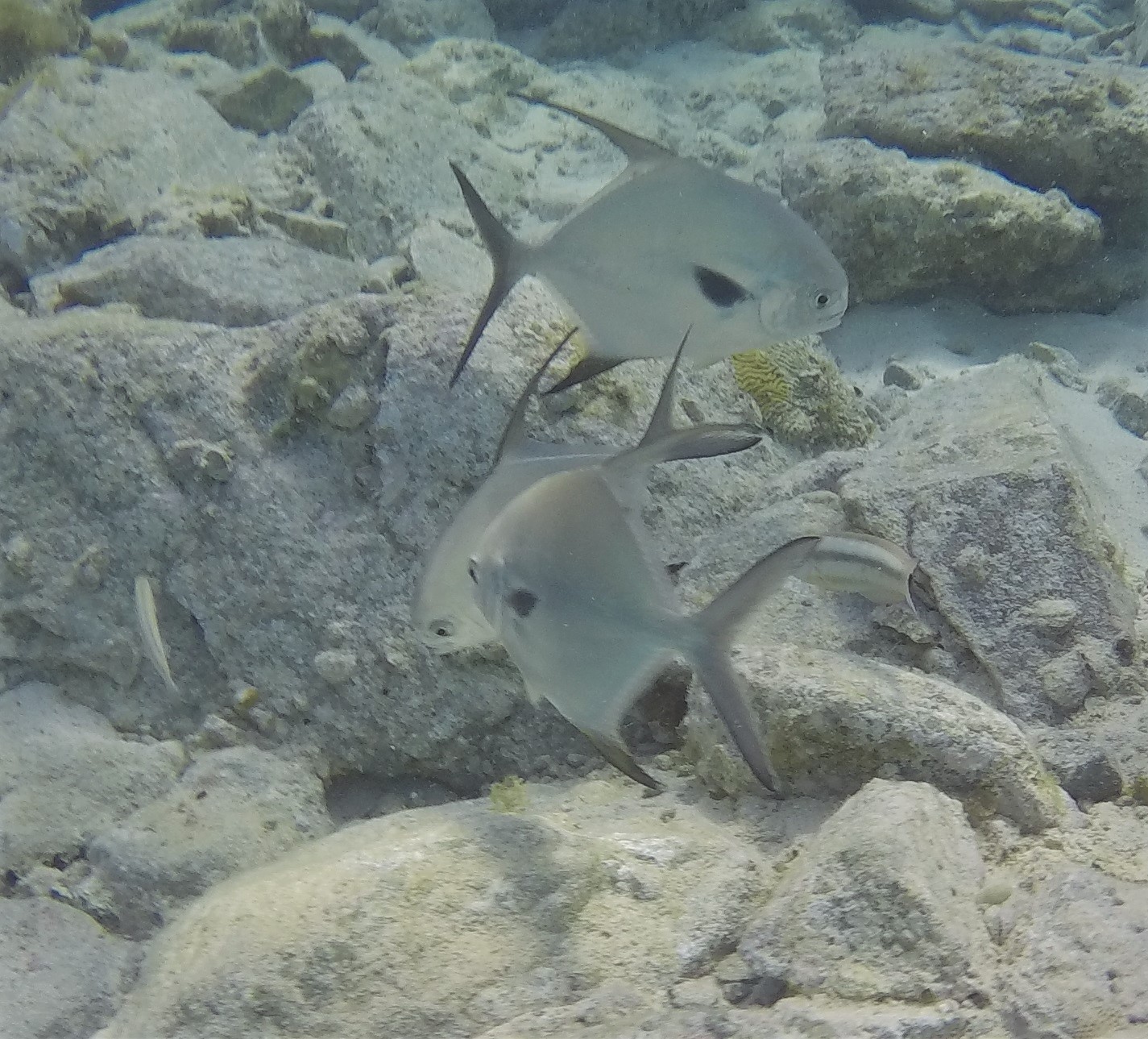
There were some nice modest reefs near where we had our mooring.  I didn’t get the color filter quite right on this one either.  A lovely French angel. 
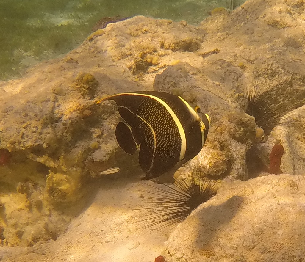
I don’t know if these sea urchins are good or bad for the reef, but there are a lot of them. 
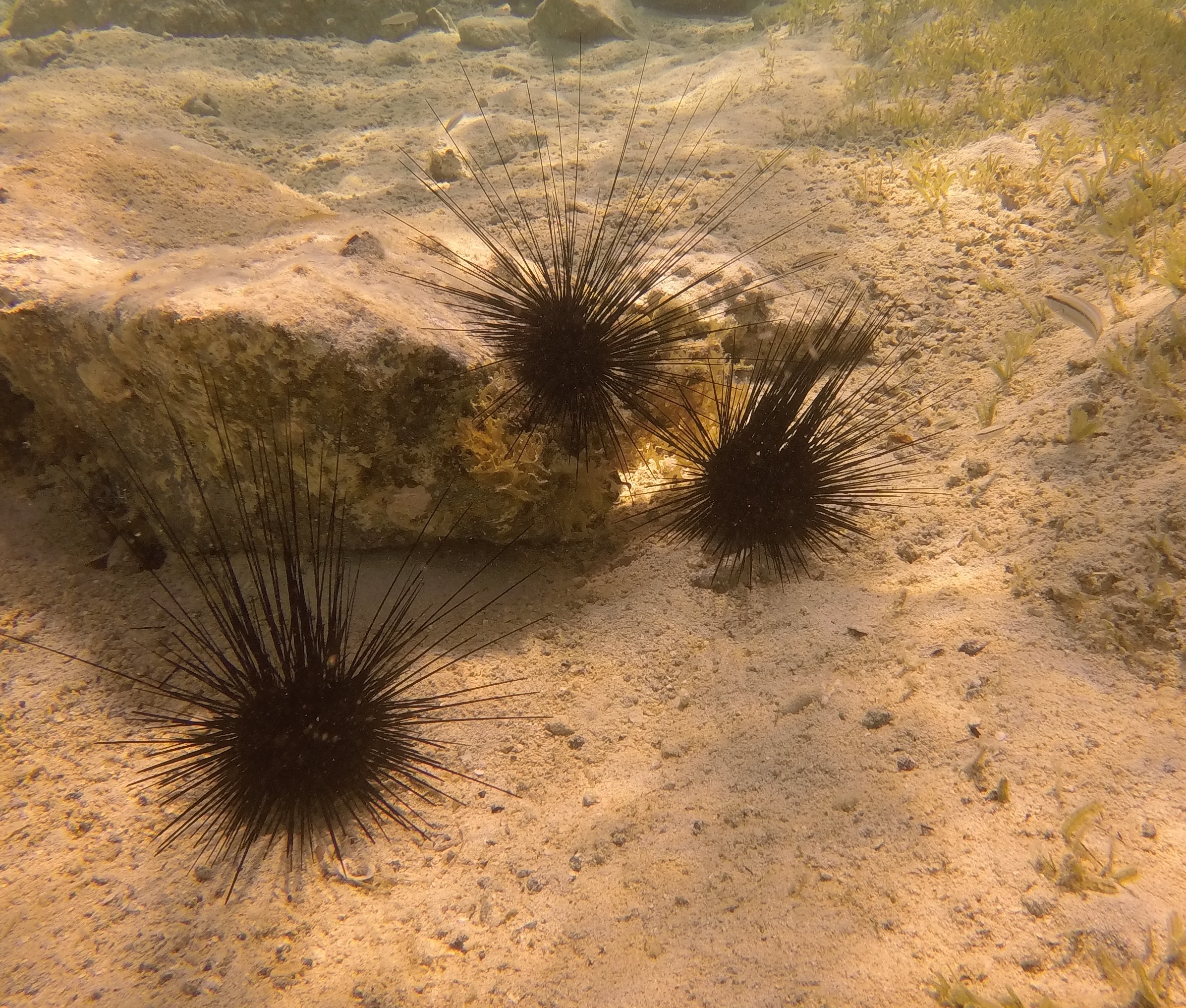
Well, I thought that I needed to put up some photos of fish before we shoved off, my first of the season.

I had hoped to use the camera  lot more this season but somehow I didn’t.  Blame the virus.  Thanks Melody, I hope to use the camera more next season.

Actually, I do wonder when the next season will be.  November?  I have my doubts. 

Anway, we are out of here.  Next stop, Florida.  

I hope to put up some posts, sans photos, along the way but that depends on being able to spend time below if Brenda is doing fairly well.   Hard to tell.

Wish us luck.

Remember, you can track us on “where in the world is Pandora”.  And, on the shared Salty Dawg Flotilla page.