Well, it’s been over two weeks since my last post and I feel badly about that so let me try to bring things up to date. Here goes…
First, recall that Brenda and I participated in the Salty Dawg Homeward Bound Flotilla, an effort designed to help nearly 220 boats, stranded in the Caribbean by the Covid-19 virus, return home following the closing of nearly every island.
While some boats in the flotilla opted to take a northerly run directly toward New England, the bulk of the fleet, like us, chose a southerly route, departing from the USVIs, heading west, south of the Bahamas and on to Florida, a mostly down-wind route.
Even now, weeks after our departure, there is still a large flotilla making their way along that same route. Here’s a screen shot of the group, 65 strong, as of this morning. 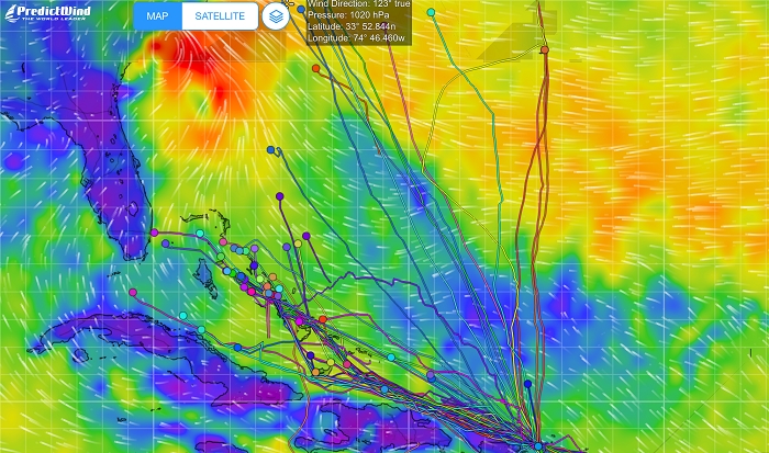 While many cruisers decided to take their boats north, some opted to stay in the Caribbean for the summer and not make the long run to the US. The decision to stay in the islands was easier said than done with most all of the islands still locked down and closed to new arrivals. As a result, they were faced with the difficult decision of keeping their boat wherever they were when islands closed their boarders, many deep in the the hurricane belt.
To avoid the risk of hurricanes, Trinidad is the only island generally considered to be safe, but that island is still closed and there is much uncertainty as to when the island will open up again and if they will do so before the hurricane season is in full swing. At this time there is hope that boats wishing to summer in Trinidad will be able to head there, by mid June, at the earliest.
Additionally, getting insurance for boats summering outside of Trinidad, at an affordable price, or at all, is increasingly difficult due to the back to back destructive hurricanes that ravaged many of the islands.
A friend of ours, with a nearly new 47′ Hanse, is paying a premium of nearly $18k to keep his boat in Antigua where his boat happened to be when everything closed down. That’s a huge premium with many restrictions and is indicative of the risk that the underwriters see for what is expected to be a particularly active season.
Happily, Pandora is now in the US and as long as I am north of Cape Hatteras by mid July, we will be in good shape. I’ll be heading back to FL in a few weeks to bring Pandora north for the summer.
I say for the summer as opposed to “forever” as I am still holding out hope that there will be a next winter season of tropical sailing but, frankly, that’s looking increasingly unlikely. Between the ongoing threat of the virus in the islands and the huge number of cases in the US, I expect that many countries will think twice before they welcome us from the US to visit.
The Prime Minister of Antigua recently stated that they may be forced to keep restrictions in place until a vaccine is available. Additionally, I am wondering about island to island travel once we are there? Will it be possible to go down the chain freely without a two week quarantine when transiting between islands?
I wouldn’t blame the local governments if they were concerned about visitors from the US given the fact that with only 4% of the world population we have a third of the deaths and no national testing and tracking plan to manage things going forward.
And another and certainly the biggest complication in all of this is that Brenda, who was traumatized by how rough it was for the second half of our trip, is not enthusiastic about stepping aboard Pandora again any time soon, and surely not about heading south this fall.
As I mentioned in my last few posts, the first half of our trip was fairly benign, with conditions that were pretty much as ordered, modest winds from behind us and seas that weren’t too bad. We even spent a few days motoring as the winds just weren’t strong enough to keep moving well. However after we departed Great Inagua, things deteriorated and were much worse than expected.
For the first few days after leaving Great Inagua, Chris Parker advised us to go slowly, no more than 4.5kts so that when we exited the Old Bahamas Channel it would be late enough to have allowed the forecasted adverse winds in the Gulf Stream off of Florida to have calmed down. With Pandora on a broad reach in 20kts of wind, keeping her speed down was no easy feat. Even with a third reef in the main and with the boom centered along with a fully furled jib we were still moving along at a good 6kts which was still way to fast.
All I could think of to slow us down more was to trail a sturdy bucket behind the boat, which finally did the trick. 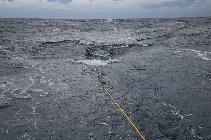 However, just a few hours later, we received another email from Chris telling us to speed up as the forecast had changed and we now had to make landfall in Florida sooner than he had expected in order to avoid a possible tropical low that was developing in the Gulf of Mexico.
So, out came the bucket and let me tell you, retrieving it was no easy task as I had not been able to put a trip line on the bucket and pulling it in was very difficult. The seas behind us, at that time, were not that large but, never the less, looked ominous. 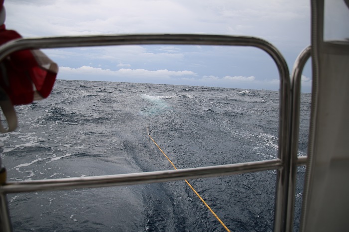 With the forecast changing, Chris advised us to go as fast as we could to avoid getting tangled up in what could be strong NE winds in the Gulf Stream, bringing with it short waves in the 10-12′ range, punishing or worse with wind and current opposing in the stream.
His email stating that there was a change in plans included words of warning, “this is going to be horrible”. Brenda loved that…
One of the key issues for us in taking the southern route, below the Bahamas in the relatively narrow channel between the banks and the north coasts of the Dominican Republic and Cuba, was to stay out of the shipping lanes and yet not stray into water that abruptly rose from 1,000′ to 20′ or less. These shoal areas are very poorly charted and waves can pile up and break with such an abrupt change in depth.
You can see the shipping channels, west and east, on this chart. Our plan was to stay just north of the west bound channel so we could be in deep water and still stay out of the way of shipping. See the “ruler” showing 3.3 miles on the chart to give a feel for scale. We didn’t want to stray any closer to the banks than a few miles, “just in case”. 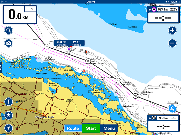 A closer view will give a feel for how close to the shoals the channel was, only a few miles. However, it seemed to me, as I planned our route, that there was plenty of room to work with.
 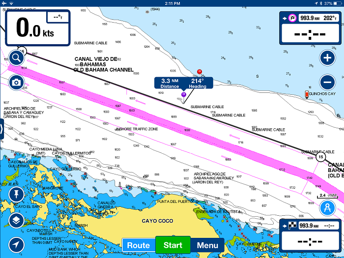 However as made our way through the area and were within a few miles of the shoals, I had serious doubts about my plan as I started to get some odd depth readings on my depth-finder. And, to make matters worse, it was in the middle of the night with no moon so there was no way to gauge the depth of the water by color.
As I came within a few miles of the shallow area on the chart, I began to see readings on my instruments suggesting that I may have strayed onto the shoals. I have found that my depth sounder often shows random readings, even when the depths are great, which I assume are schools of fish, temperature gradients, seaweed or other debris that cause the instrument to flash random and very shallow depth readings from time to time.
However, in the dark of night and with little sleep, I really didn’t know what to think. All I could imagine was that the charts were wrong as I was seeing accurate readings suggesting depths of less than 20′, and counting down slowly to ten feet and less, only to begin counting back up to deeper readings before loosing depth readings altogether as we headed back off-soundings. It sure looked to me like a grounding was going to happen at any moment.
Here I was, in the middle of the night, sleep deprived, and I wasn’t sure what to think as I just didn’t know what to make of the readings. After seeing the depth readings methodically count up to alarmingly shallow depths and then back down, I became convinced that I was going to run aground at any moment.
At one point, after “bracing” for what seemed like an inevitable impact, with readings near the depth of Pandora’s keel, I decided to jibe, turning sharply away from the imagined shoals and back toward the shipping lanes only to see a continuation of unexpected readings. I really have no idea if I was close to running aground or not but the charts, if they were correct, had me at least several miles away from the shoals. The good news is that we didn’t run aground but I am still unsure if it was the instruments or if I was really in danger. I guess I will never know.
The first time I had experienced this was was in 2016 off of the south coast of Cuba, again late at night, in depths that showed on the chart as nearly 5,000′. It was totally unnerving then too. In retrospect, with a mile of water under our keel then, the readings were surely false.
After jibing and back toward and area that I was certain were plenty deep, we raced on to the west and Florida. As we passed the Cay Sal banks to port, our course turned to the NW and we entered the Santaran Channel. The wind freshened and squalls increased. Still double reefed and with a fully furled jib we were now on a beam reach and moving fast.
Pandora, sails really well on a reach in those conditions, a double reefed main and no jib and we were flying along at 8.5 to 9.5 kts, sometimes as fast as 11 kts. We were regularly hit by squalls with sustained 30 kts. One squall followed along with us for nearly 8 hours. That was a wild and wet ride and, as luck would have it, was in the dark with no moon so we couldn’t see what was coming until it hit us, and hit us it did.
Regularly, larger waves would slam into the side of he boat and rush over the deck. One wave hit so violently we both thought that the vinyl enclosure on the aft of the cockpit had been blown out. So much water came across the aft area of of the cockpit from the starboard side that we really thought that the enclosure had been breached. As it was pitch dark at the time, it was difficult to see clearly but what we thought we saw, was quite unnerving. Later, another wave hit the starboard beam with such a bang that I went below, sure that one of the ports had been breached.
Earlier in the trip, when we were running nearly dead down wind, we were “pooped” several times with waves rising up behind us and slamming violently against the transom. Fortunately, not much water found its way into the cockpit but it made quite a noise.
A 40′ catamaran that was close behind us, was not so lucky and as a large wave ran up their stern, it flooded over the aft deck, stove in their in their big sliding cabin doors, and soaked their cabin. They were able to clean things up and keep going but sustained a lot of water damage.
And, a number of other boats, mostly smaller ones under 40′, had boarding stern waves shove water up their exhaust, flooding their engines. As a result, they couldn’t get their engines started, unable to find a way to get the water out of their engines while underway. A water-locked engine can be a common problem when waves hit the transom if there isn’t enough rise in the exhaust from the engine to where it exits the transom. Unfortunately, salt water left in an engine for several days can be fatal to the engine.
Fortunately, Pandora’s exhaust system exits the transom close to the waterline following a large rise that brings it up under the cockpit and then down low again under the companionway before rising yet again to meet the engine. Given that final rise to the engine, if water were to find it’s way into the exhaust, it would likely not reach the engine itself.
As I have doggedly pursued leaks aboard Pandora for years now, we had very minimal water below, in spite of the rough conditions, with the exception of a “new” leak around the mast boot on deck which got our custom mattress quite wet. When we arrived in Ft Pierce I fully rinsed the mattress with fresh water and purchased a dehumidifier and a fan to be sure that it dried out quickly before any mildew set in. I think it’s fine now but time will tell if it ever feels clammy. Frankly, I was surprised that we didn’t develop more leaks given the massive amount of water that we took on deck.
Crossing the Gulf Stream, in conditions with about 30kts out of the east turned out to be a lot easier than I had expected except that a particularly persistent squall stayed with us for nearly eight hours, making for a miserable night. We could see the squall all around us on radar but as we moved toward the NW, we were unable to move away from the rain and wind as it was moving in the same direction as we were, hour after long hour.
But wait, there’s more. Things finally quieted down as we passed Miami but as we approached Ft Lauderdale, an hour before daybreak, we were hit by yet another nasty squall, just as we approached the sea buoy at the end of the channel.
Conditions were quite rough and as I dropped the main, the boom dropped lower than normal and nearly slammed into the top of the hard dodger. Normally, the hydraulic vang holds the boom up but somehow some of the pressure had leaked out and it drooped down more than it should have.
I thought that the topping lift line was up enough but it wasn’t and the boom nearly crashed violently into the top of the dodger as the boat rocked from side to side in the swell. After a few alarming moments as the 20′ boom slammed from side to side, I was able to secure an out-haul to stabilize it but working my way up onto the deck as the boat rocked violently was not fun especially after two days and nights with little sleep.
It’s safe to say that all of this was not amusing to Brenda but we made it and finally passed the breakwaters and entered calm waters. We were back in the US.
When Brenda and I had been discussing the best options for getting us and Pandora home, we decided that her getting on a plane with the risk of contracting the virus so she reluctantly decided to make the run back to the US with me in what would be the longest run for her to date, some 1,500 miles, beginning in St Lucia, all the way to the US.
While the final run from the USVIs to FL was only about 1,100 miles, it was still nearly three times longer than her longest run to date and along the way the only option to stop and rest was Great Inagua, an unpleasant and exposed anchorage, with every other port closed and off limits, if things deteriorated.
So now, with Pandora back in the US, even if it’s only Florida, it’s looking very iffy that I’ll be getting Brenda back aboard any time soon.
Brenda wanted the run home to be a “zepher” but it turned out to be more like a “tempest”.
I guess time will tell with what the next chapter will look like for me, Brenda and Pandora. For now, I’ll just focus on getting Pandora north and as Scarlet O’Hara once famously said.
“I won’t thing about that today, I’ll think about that tomorrow.”



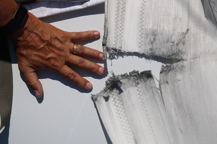
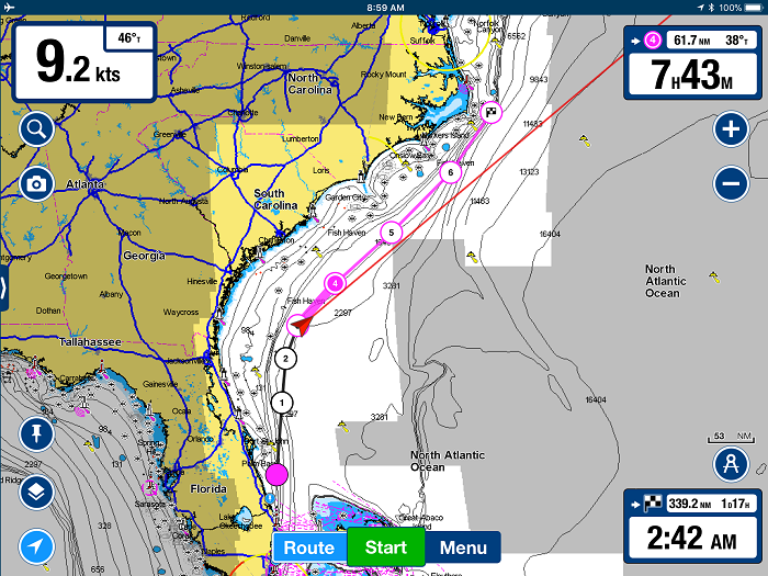 We tied up at the Hampton YC yesterday for one night, in part, because we had to address the misaligned roller foil and fix the rip in the jib. Trying to do that at anchor, with the boat swinging to the wind, would have been quite challenging.
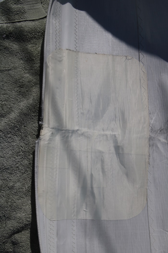
 All, sort of, better now. This should make our sail maker happy.
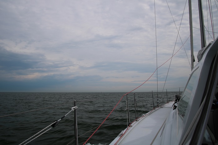
 So, here we are, motoring along in flat calm conditions, making our way north.
  Pandora will be at a small marina off of Whitehall bay. Remarkably, the cost per month is only about 2/3 of the cost of a mooring in CT. It will be a sort of “coming home” as we kept our “old Pandora” in the same marina, the one with the two head stays in the middle of the photo, way back in 2010. I hope you are impressed that I was able to find this photo of that spot.
 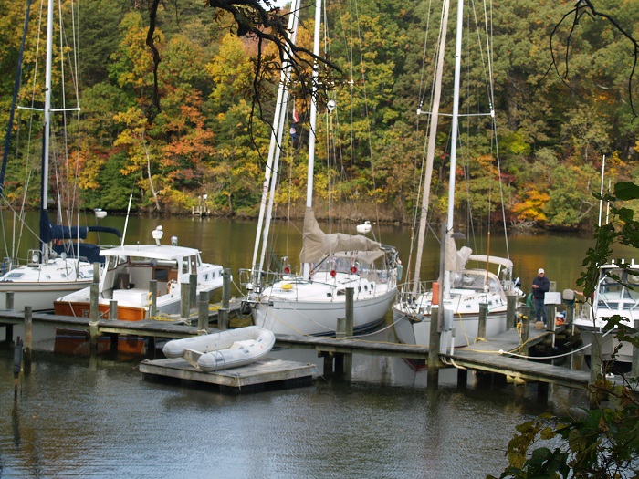 It’s been a long time since I’ve kept a boat in the Chesapeake and what I remember most is that it is HOT!
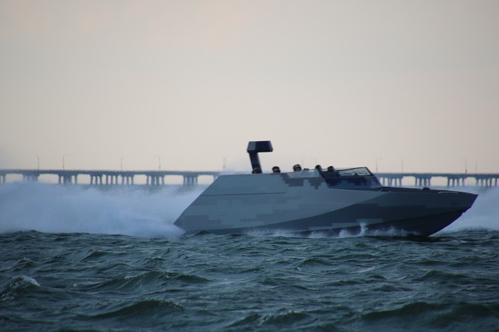 Of course, in the time of a pandemic, they blasted along while keeping an appropriate social distance. I would LOVE, LOVE a chance to get a ride on one of these. What a rush that would be…
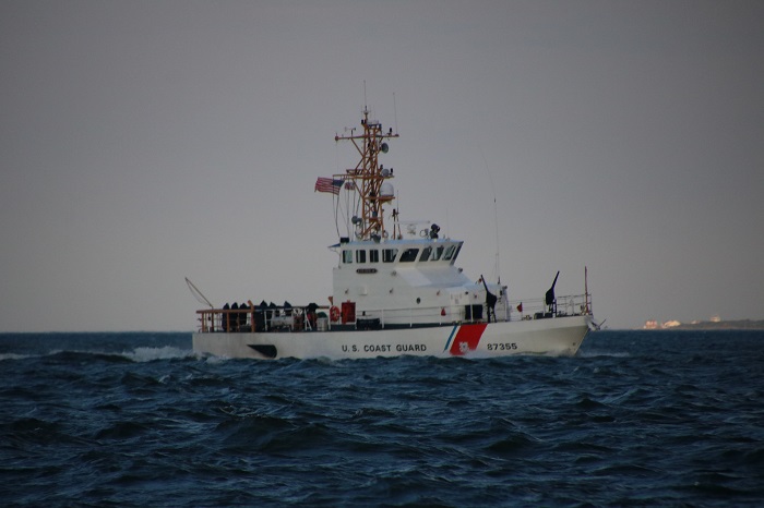 They say that form should follow function and this dredge is a perfect example of that. No way to imagine the ship being used for anything but dredging up silt and sand. I spoke to the captain who said that they just “wanted to make the world a better place”.
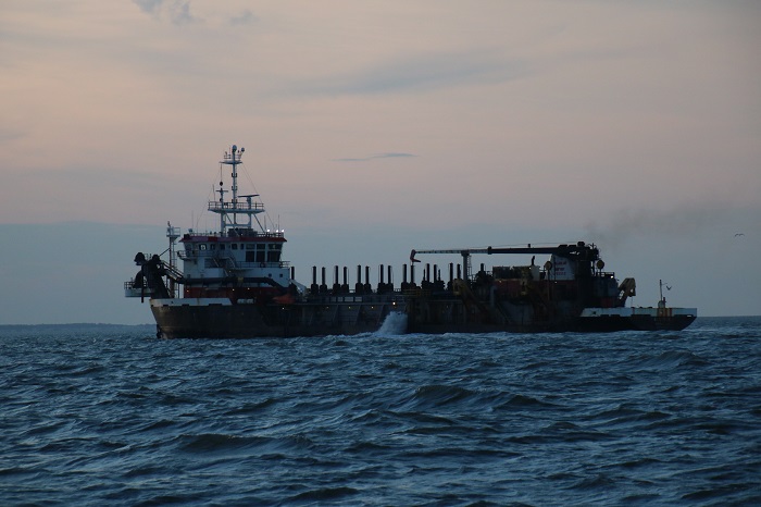 So, about the bow of the ship. If form follows function, I have no idea what the what the function of this form is.
 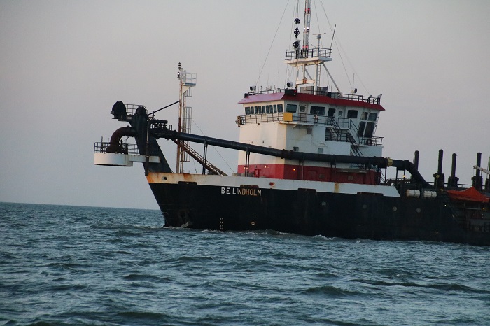 So, here we are, still motoring along, making our way north, the last leg of our trip, for the moment, hopefully for a more than a few moments.
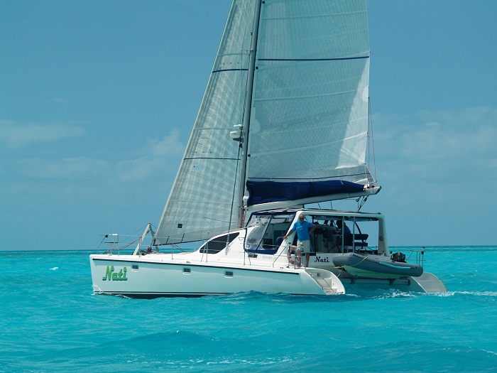
 It seems like just yesterday when we spent months with Anne and Dick moving from place to place in the Bahamas. I guess that Dick never listened to his mother who surely told him NEVER to stand up in a moving vehicle. “Down boy, down boy!” With Anne aboard at least she kept him moving at a stately pace.
 At that time we owned our “old” Pandora, a SAGA 43. She heeled a LOT and to sail along with Nati, a cat that was always level and smooth, was totally annoying, especially to Brenda who often felt she was hanging on for dear life as I pushed Pandora to try and keep up. While we had to stow everything that wasn’t nailed down, Anne and Dick would just wave to us while taking at tiny sip of coffee as they glided serenely by.
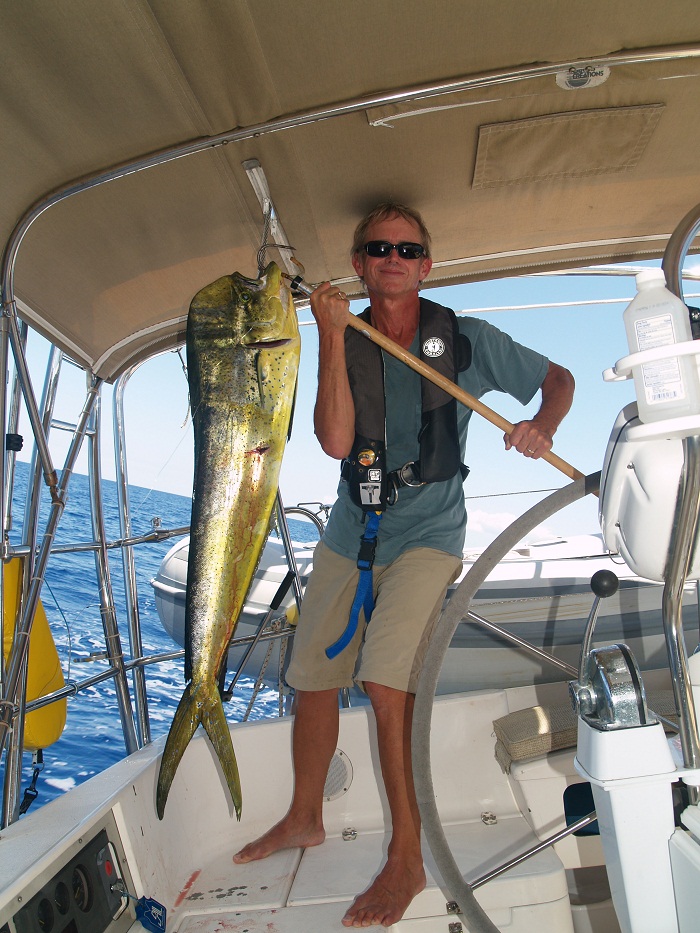
 We did a lot more fishing back in those days. Now, I am less inclined to get all the blood and guts aboard as we have found that the biggest problem with fishing is that we catch stuff and when landed I wonder how I am going to deal with ALL THAT FISH. This was one of my biggest catches that year, a Mahi Mahi. Notice the beginning of the whole “blood and guts” thing on the cockpit settee.
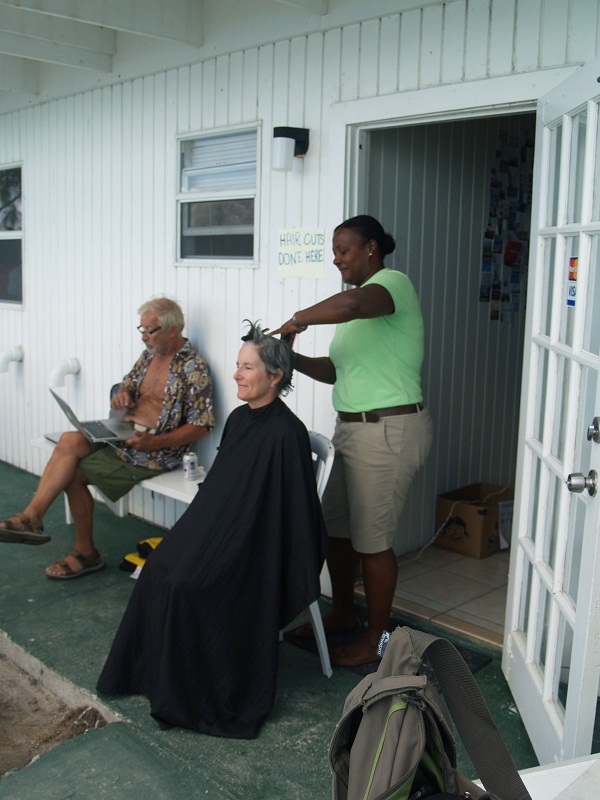
 We all had a bit more hair back in those days. Well, at least it was a lot better distributed. I guess I’ll have to wait and see about Dick and how his mane has fared. In terms of sheer volume, my hair is pretty long these days as I haven’t had a “professional” haircut since February but somehow it has become distributed differently, a sort of gravitational migration leaving my own personal “north pole” mostly vegetation free.
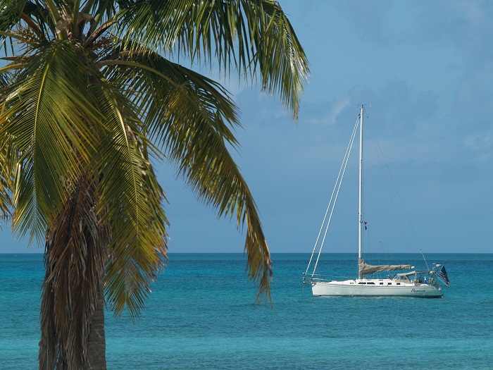
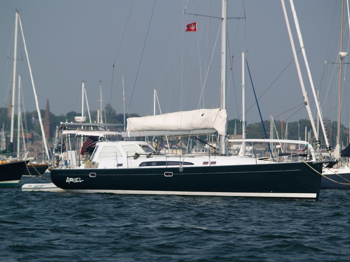
 And, later that same year, a random sighting of what would one day be our current Pandora on a mooring in Newport RI. We never imagined that we would one day own her ourselves.
  So, off to Florida and Pandora in less than a week. And, while I am not enthusiastic about getting on a flight, that’s exactly what I am doing next weekend. You can bet that I’ll be fortified with my slightly used N95 mask, germicidal wipes, killer spray, hand sanitizer, my own food and well, you know the drill. Actually, my hope is that EVERYONE else on the plane knows th drill and takes it seriously. If not, it will be my last flight for a very long time. Bad flight or not, I hope that I don’t become “positive”, which I suppose could make it my “very last flight, ever” which would be very bad. Based on our experience in Florida when we arrived there last month aboard Pandora, I am not optimistic about the “locals” taking the risk seriously.