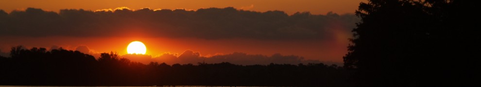
Sail Pandora

Waiting out Sandy here on the Waccamaw River SC

As I begin this post, it’s Sunday morning and Pandora is anchored in a very scenic spot on the Waccamaw River in South Carolina.  This part of the ICW is fresh water as we are in the middle of a cypress swamp complete with Spanish Moss, tea colored water and all surrounded by low country.  Here everything has to be able to grow with wet feet as there isn’t any dry ground anywhere.

We left Southport on Thursday with the goal of getting a bit further south and away from hurricane Sandy as she churned up the coast.  The recommendation from Chris Parker, the weather router that we use, was that the further south we were when Sandy headed by the better.

It’s hard for me to sit still this long but here we are for the third day after coming down from Southport to Myrtle Beach, where we tied up at a marina that had been recommended by a number of folks as a good place to spend a few days.  The marina is adjacent to a large shopping area.  Unfortunately the “shopping” didn’t include access to any food stores within a reasonable walking distance and the rest of the shopping was primarily a tacky mess of tee-shirt shops and chain eateries.  After one night there I couldn’t stand the thought of paying for another three or four days to be somewhere I didn’t particularly want to be.  The other boats that were in the marina were primarily powerboats and generally folks that never anchored out, just heading from one marina to another, a different mindset compared to the “off the grid” sorts that I generally hang out with.   What, no solar panels?  More than anything though, I am just too cheap to pay for a marina when I can anchor for free.  Besides, I hoped to find a place that was more protected.   Me, I’d rather spend money on food and drink.

After some discussion we decided to head a bit further south and find a good hurricane hole on the Waccamaw River.   Where we are now is quite protected and while the storm hasn’t passed completely yet (as of Sunday morning), the sun is beginning to peak out and the winds are still gusting into the low 20s.  While it’s a good amount of wind, it’s nothing like we would be seeing in a more exposed area where it would be more like the 40s.  The oxbow off of the river where we have anchored isn’t much more than 100′ across here and is surrounded by cypress trees and swamp everywhere.   One particular benefit from wind is that the mosquitoes are not able to do much to annoy us.  I expect that mosquitos can’t fly at 20kts.   Those gusts have to be hell on them…

On our run down the ICW from Southport to Myrtle Beach we passed all sorts of development including some that looked like they had stopped mid construction years ago and never got going again.  We passed strings of private docks built on the waterway where there were no houses, just street lamps and roads.  I guess they were “delayed” by the recession.

However, there was still plenty of examples of conspicuous consumption in Myrtle Beach, home to over 100 golf courses.  How about this little vacation spot?   It’s a bit tacky to be sure.  I wonder if the owner is happy or sad that they purchased this at what was surely a high price.

Or this one perhaps. You have to love the infinity pool and all that blue tile. I am told that the locals refer to this area as the Italian Riviera.    Works for me. But wait, there’s more!    This development even had a highway bridge that matched the local aesthetics.   At least it was the regulation 65′ clearance.  Every one of the many bridges we have passed under on this trip have been your usual concrete ones.  Not in Myrtle Beach, at least not in the “high end” part of the neighborhood.   I wonder if the trash cans are color coordinated.  Hmm… Well, as we passed south we entered the much more remote Waccamaw River and were treated to a view that was more primeval than planned.  And, here we are, anchored on an oxbow off of the main channel and ready for the storm.  As of Sunday morning, as Sandy passes us offshore, it’s more windy now than has been the case for us in the two days we have been here.    At the same time it’s also becoming brighter with a bit of blue peaking through. Remote or not, we continued to have cell coverage although it was strong enough to talk on the phone, data wasn’t working during the storm.    So, now that it’s Monday morning and it’s dead calm the full moon in a clear sky has now set and we have good data again.  Go figure.  In any event, I am able to finally finish this post, a few days in the making.

As I finish writing, Sandy is continuing to churn up the coast and is expected to make landfall near Atlantic City sometime tonight, Monday.  As the storm is such a whopper, the expectation is that there will be a big storm surge and it is expected to be greatest north of the storm, in Long Island Sound and New York Harbor.

Brenda and I are very happy to be here and not further north.   Today we are looking forward to being on the move again as we continue on our trip south.   Yesterday, as the wind whipped around Pandora we took our dink ashore to a marina across the way to meet up with the aunt of one of our friends LeaAnne and Garrett, Garrett’s aunt actually, the 88 year old aunt June.

June, a real pistol and southern lady if there ever was one, picked us up shortly after noon yesterday to  show us the sights including a local sculpture garden that was just amazing.

However, I will have to leave the details of our great day with Jume for another post.   For now I will leave you with a pre-Halloween wish brought to you by Radar, the loyal boat guard traveling along with Frank and Gayle, friends of ours who are making the trip south as well this year.   When they heard that we were anchored here, they decided to make a stop at one of the local marinas, actually the same one where we met June yesterday.  After our day ashore we had a lovely dinner with Frank and Gayle.  We met Frank and Gayle some years back after they returned from years cruising in the Med, Turkey in particular,  aboard their SAGA 43, Alcid.   This time they are aboard a power cat, stinkpot, for a change of pace.  This boat, all 35′ of her, powers along at 25kts compliments of twin Volvo Penta 225 hp diesels with a total of 500hp.   Well, while they may outrun us by a factor of 4x the speed of Pandora, I take some solace in knowing that they are paying about 8x as much for fuel.   While we count our consumption in the miles per gallon range, there’s is more like gallons per mile. What, you can’t make Miami in a day from here?

So, again, Radar, all dressed up in his lobster suit says, Happy Halloween!!! Doesn’t he look humiliated?  Poor guy. His mother is tough on him as you can see.  However, he is from Maine and all dogs in Maine have to dress up as a lobster at least once.Today?  The sun is out and we are finally on our way again.  And, this post is FINALLY done!!!

In Southport NC and what to do about Sandy?

It’s Wednesday afternoon and we are on a dock in historic Southport NC.    When we got here today I couldn’t find a place to anchor in spite of the guidebook saying that there was room for at least one boat in the little harbor.  I did try to anchor but couldn’t make the anchor bite securely in the very soft mud.  Alas, on the side of the Fishy, Fishy Restaurant, there was a phone number above some docks on the back of the place that were labeled “for patrons”.  Me?  I could be a patron and decided to call.   So, the deal is that if we eat at Fishy, Fishy (that’s just so fun to say…Fishy, Fishy) we could stay overnight for $25.  Sold!!!  I asked what the depth at the slip was and he said 7′ at low water.  Double sold!

So, we got the fenders and lines ready and I powered into the slip.   Well, actually, I was only able to get about 10′ of Pandora into the slip when we eased into the muddy bottom and stopped. Yes, it was low tide and no 7′.  Alas, what to do?   After a moment of reflection I did what any red blooded American would do and just increased the power on the engine and plowed through the mud.  As I oozed along, I asked Brenda to tell me when the bobstay was about a foot from the dock.    Needless to say, by the time I was “in”, we had plenty of time to tie up as we were hard aground and weren’t going anywhere.  The good news is that there is a 5′ tide here and now that the tide is in we are happily floating.  Note to self…don’t leave at low tide.

Fishy, Fishy is a fun waterfront dining establishment boasting “the finest margaritas in the world”.  I’ll be the judge of that.  At least we won’t have far to walk after dinner.   There’s a marsh area adjacent to where we are tied up so the view from our cockpit is very nice.  The boardwalk goes way out into the marsh.  It’s an impressive structure. Here’s a shot taken from the end of a board walk that goes out into the marsh.  Pandora is the boat on the right.  Note the subtle wording on the roof. Here’s a shot of Pandora from the dining deck. Isn’t it nice of us to give the other patrons a good view?  Oh yeah, I forgot to mention that it’s 85 and sunny here.   A good night to eat outside.  Adjacent to where we are tied up is a fish market that sells shrimp and only shrimp that they catch with this boat.  I bought a mess of shrimp for $5 a pound, head and all.  They said that they would clean them but recommended that I cook them with their heads on as the flavor would be better.   I’ll give that a try. Southport is very close to the Cape Fear inlet and has been a prosperous town for a long time.  Now it’s more about tourists but it was originally a port town and a wealthy one at that.  The homes in the area are really nice with palms and massive live oaks everywhere.    I am a big fan of white homes with big front porches.  Happily, nearly all are very tasteful, like this one. If you head out to the street that is adjacent to the water, the view is just spectacular.   How about this for a place to watch the world go by?This is another view of the street adjacent to the inlet. I would say that this home wins the “front porch charm contest” hands down.
As we were headed down the ICW yesterday I am afraid that many of the homes, while massive, lacked the southern grace of Southport.  While perhaps a bit more “unique” than most, this home was a standout?  Old money? Perhaps not.And, in the winner of the “best lawn ornament contest” goes to….Speaking of wildlife, I just love the pelicans.  To me, they seem to be saying “listen buddy, don’t get any closer or I’ll poop on y0u!  AND, I MEAN IT!!!Last night we stopped at Carolina Beach, more of a massive marina than beach.  We went ashore for a drink and spied this really nice sports fisherman.   I can’t imagine paying for the 60 gal/hr to run this baby but it’s pretty elegant.
Perhaps this lovely Nordhaven trawler is more of our style.  We met this couple the other night and have been ending up in the same harbors as we head south.  They are from Noank CT. With hurricane Sandy headed up the coast in the next few days we have to continue south to put some more distance between ourselves and her landfall so we will have less wind.  The current track has her coming up to Bermuda and then heading northwest and making landfall somewhere between the Chesapeake and Nova Scotia.  One way or the other, we expect to have winds in the 30+ range along with rain on Friday and Saturday.   Our plan will be to find a good safe place to anchor that’s protected and wait for better weather to head further south.

For now, I am looking forward to dinner at Fishy, Fishy and one of their margaritas.

Inside? Outside? Inside? Outside? Let’s join the Marines!

Each morning I take a look at the weather to see what’s on the horizon for the next few days.  On Monday morning in Beaufort NC, I was reading a tropical weather forecast from Chris Parker, the weather router that we are working with on this trip, and saw that he perceived a possible threat from an intensifying weather system that might threaten the East Coast, and us, in the coming week.

Based on this I decided to talk to him on the sideband radio when he was giving his morning weather briefing.  Chris’s routine is that he talks about the weather and then boats that subscribe to his service can ask questions.  I had two questions for him.  One, would he advise that we stay in Beaufort for a few days or would it be better to head south with the hope of getting out of the way of the storm as it tracked northward by the weekend.  Second, what was the wind forecast for making a run from Beaufort NC to Charleston SC, a 210 km trip that would involve an overnight run.

First, Chris felt that there is a 20-30% chance that the storm will head up the Eastern Seaboard and perhaps make landfall in the Chesapeake.   Most models have the storm heading out to see and going over Bermuda by the weekend.

He also felt that we could get some good sailing in by heading offshore for our run south.  Having said that, Chris also said that while the winds were good on Monday, they would likely decrease as our trip wore on.    Hmm… What’s a sailor to do?  Offshore sure sounded great to me but I wasn’t too keen on motoring  half of the way if the wind pooped out.  Also, many folks we talked to had recommended that we do the ICW run to Charleston at least once as it’s a lot of fun and there is so much to see along the way.  Also, we will have to run outside from Charleston to bypass Georgia as there are so many areas there that have shoaled in that making the run in Pandora, with nearly 6′ of draft, would be challenging.  The jist of this meant that if we were to run outside to Charleston and then again south from there, we would miss much of the ICW fun.

Also, there was that niggling issue of Brenda’s concern about going out overnight, something that she has not yet done.  Actually, with all of the “normal” women we have met telling her that it’s not bad and actually fun to sail at night, Brenda is beginning to come around to the idea.  However, it’s clear to me that she’s not there quite yet.

So, what to do?  Well, by the time we had the information from Chris it was mid morning and the day was getting away from us.  The problem was that each hour that we delayed in getting on our way made it more likely that we would arrive in Charleston in the dark, something that I didn’t particularly want to do.

So,we headed to the fuel dock to fill up on fuel and water ($4.15 a gallon, thank you!) and headed out of the harbor.   As we headed out into the channel we were still reviewing our options and as we got to the “decision point” where we had to turn right and head down the ICW or head out to make the run offshore.  What did we do?

Inside?  Outside?  Inside? Outside? Much discussion…..   Well, we decided to take the scenic route and go down the ICW.   Me?  I’d have preferred to do some sailing as I fear that I may have forgotten how to take off the sail cover in the weeks since we have actually sailed.  However, given the diminishing winds and the possible night landfall, perhaps inside was best.

So, where’s Pandora and what’s this thing about the Army?  (Don’t forget to visit the “Where’s Pandora” button on the home page of my site.)  Given our somewhat late start, a logical place to go was a neat anchorage maintained by the Army within Camp Lejeune.   So, we decided to “join” the Marines in their anchorage.

As we headed down the ditch, I have to say that it is very pretty even if we were motoring.   The water on each side of the channel is very shallow, usually only a few feet deep so you have to stay watchful and stay in the channel.   It’s also fun as the bouys don’t always match what’s on the chart.  The charts on my plotter are a few years old but those on my computer and my paper charts are new this year.   There were still differences in some channels where there is a good amount of current moving sand around.

We did find our way fairly well most of the time but we did get a bit confused at one point and ran hard into a sandbank at nearly 7kts.  I expect that a good part of the reason for our error was because we were distracted by a dolphin swimming so close to the boat that the spray from his/her blowhole was getting into the cockpit.  That distraction (yes, I’ll blame it on Flipper) caused us to take a small mark the wrong way and oops, we came to a crashing stop.  Me?  I was on deck trying to take a photo of our visitor and when we came to a shuddering stop I nearly lost my footing.  Alas, I was able to stay aboard.  Whew!  It would have been doubly frustrating had I fallen over and broken my leg on the sandbank.

Dolphins visited us often, especially near the inlets and at one point I was down below and watched Brenda as she lurched from one side of the boat to the other, camera in hand trying to get the perfect shot, or any shot that actually showed a dolphin instead of bubbles.  Alas, she was always a bit late to get any pictures.

So, what about dolphin photos already?   This is about the best example. Perhaps a video camera would work better.  Not sure who was more fun to watch, the dolphin or Brenda.  Her antics were very cute.  The foam in the foreground?  That was where the dolphin was a mere second before she took this photo.   As we approached Camp Lejeune we saw a good deal of aircraft activity, particularly the always controversial Boeing Ospreys.  These planes (or are they helicopters?) are amazing to watch.   They take off like a helicopter and fly like a plane.   Two flew by us several times but not close enough for a good shot.

Lest you forget that you are visiting Army land, this was a somewhat unsettling sign.   Along the bank there were also sand and cement ramps that I was told were for hovercraft to enter and leave the swamp.  I wished that we had seen one of those.
The swamp land surrounding the ICW in this part of NC is very flat with marshes in all directions.  Some parts are completely flat with nothing but marsh grass.  It’s very serene. The trees look more like they have been affected by the wind than up north.  This shot shows it well.   Almost looks African.  Wildlife, birds at least, are everywhere.  No more bald eagles but plenty of herons and egrets.  Not a great shot but this heron was very pretty.  We also saw our first ibis or actually, our first ibisses (is that plural for ibis?).   Not sure that this link is the actual type of ibis but you get the idea, curved beak and all.    No ibis photos of our own just yet. Today we head to Wrightsville Beach and will once again enjoy going under and through a number of bridges along the way.   As I finish this up we have already run aground twice (yes, we got off) and have adjusted out speed to deal with once an hour bridge openings that we were way too early for.  I’ll have to work on that.

Being in Beautiful Beaufort NC and closing another loop, sort of.

It’s Tuesday morning early and we have been in Beaufort NC for two days now.  Being here is yet another milestone of sorts for me as it’s the first place that I/we have visited on the ICW that I have been to once before by boat.   Beaufort was the first stop for me in the USA when I helped bring back The Abby from Nassau Bahamas in May.

It’s been fun showing Brenda around town and visiting some of the same places that I went to back in May.  When I was stuck here with the rest of the crew of The Abby while we waited for tropical storm Beryl to come by.   While I enjoyed Beaufort then, I thought that it would be even better with Brenda.  I am happy to report that I was right, it’s even better now.

The weather has been just terrific with warm days and cool nights and it’s also nice to see (mostly) clear water again after the muddy waters of the Chesapeake and tannin stained waters of the canals.  While the water is indeed clear, and again salty, I am told that it’s no match for what we will experience in the Bahamas in a few months.

It was a real thrill to see our first bottle nose dolphins when we first arrived.  Alas, theirs was a brief visit while we were enjoying cocktails on Sunday evening and I didn’t have time to get my camera.  “Flipper, Flipper, come back, I need to take your picture!”  I am hopeful that there will soon be more opportunities.

However, all is not lost as the wild ponies made an appearance last afternoon and  patiently posed for their photo op while Brenda and I motored the dink back and forth.   We were perhaps 100′ from them while they were grazing on the shore and within a stone’s throw of Pandora.  OK, perhaps a stone’s throw for The Incredible Hulk, but closer than most will ever be to a wild horse by boat.  These guys/gals looked totally non-stressed by our buzzing outboard so close by.  They never even looked up. If one pony picture is good, two is better. There was also a large egret hanging out with the horses, perhaps to snatch up any fish that were spooked by them as they moved through the shallows.  I am not particularly good at catching shots of flying, or about to fly birds.  Yes, it’s hard to see that this is an egret but you will have to trust me on this. Beaufort is quite unique as I can’t imagine that there are many places in the world where you can anchor a boat and be as close to four star dining as four legged creatures of the wild horse sort.   And, just to prove that I can take photos of things that fly, here’s a shot of a small butterfly that I got when Brenda and I went for a walk yesterday.   I must have looked like a 10 year old with a net chasing this bug around someone’s front garden with my camera.  “Hold still you *&% bug, Brenda says that I have to take a photo of you.”   It was the only photo I was able to get.  Good thing that it turned out.  By the look of the photo, you’d never know that the garden was totally overgrown and the house looked like it was going to fall down almost any minute.  Our last stop before coming here to Beaufort was Oriental NC where we enjoyed a nice evening anchored in the little harbor.  On the chart you’d never know that there was room behind the breakwater for even one boat, much less the dozen or so that crammed in for the evening.   We went for a walk but I have to say that the architecture wasn’t much to write home about or take photos of.  However, it’s a very nice place to visit.   They did have some pretty neat shrimp boats though. Speaking of shrimp boats, I am told that parts of the movie Forest Gump, the fishing scenes in particular, were filmed here in Beaufort.

As we made our way from Oriental to Beaufort on Sunday, we went through yet another long canal (against the current, some points as strong as 2.5kts, I might add).  This pretty motor sailor passed us looking very sharp.Speaking of boats, how about this “pirate ship”?  I expect that I’d have to drink lots of rum to be willing to be seen in public aboard this.  That, and an eye patch over one eye, or over both eyes “where’s Bobby?” to hide my identity.   Yesterday we had lunch with two nice couples.  One,the local SSCA cruising station hosts, Normandy and Michael, for Beaufort.  They recently moved here from the West Coast and are getting ready to cruise again.  It was fun to hear about their cruising in Mexico and Baha and yes, they did get here through the Panama Canal.  The other couple, who we had met at the Annapolis Gam, Melinda and Harry Schell of Seaschell have lived aboard for over ten years.   We had Melinda and Harry over for sundowners last evening and enjoyed learning more about what to expect next on our trip south.    It’s interesting how often we run into people that we know on this trip.  You’d expect to be a bit starved for company going from harbor to harbor, but we keep running into SSCA folks and it’s more like a movable social event than a solo cruise south aboard Pandora.

We have been debating what’s best for the leg to Charleston, inside down the ICW or a jump and overnight run outside.  Melinda said something that we have also heard from others, suggesting that everyone should run down inside at least once.   That might be a good idea as there are some fun places to visit between here in Charleston that we would miss if we did an offshore run.

Today we will be “buddy boating” with Seashell, I think to Cape Lookout and a walk on the ocean beach.  That should be fun.  Laundry first, perhaps.

What, no sunrise or sunset photos to close the post?  Sorry, not today as I am done with this post and the sun hasn’t come up yet.   Well, it’s almost up but not quite.  I just looked out and it does look like it’s going to be a fine day.    Still no photo?  You’ll just have to trust me on that.

Back into civilization at Oriental NC, sort of.

It’s Friday morning and we are underway, having stopped last night in a lovely little harbor about 25 miles north of Oriental NC where we are headed.   In Elizabeth city we went to a fish market and bought a peck of oysters.  You can’t buy a dozen oysters there, it seems.  The options are a bushel, half bushel and a peck.  I have heard of a peck of pickled peppers but never one of oysters.  So how much is a peck of oysters.   Let me tell you, it’s a lot, between 15-20 lbs.  That’s a lot of oysters.  Luckily, I am getting pretty good at opening them.  We have had about 1.5 dozen oysters on the half shell two nights in a row and there are plenty left.   So, how about raw oysters with Hendricks gin and tonics?  It’s as good as it sounds.  Totally… Having seen so many fabulous sunsets and sunrises here it’s hard to say if this was taken last night or the one before or if was a sunset or sunrise.  However it’s certain that it was in the last few days so you will just have to trust me on that.

The sunset, no wait, it was a sunrise, got even better a bit later. It’s been several days since I have last posted because cell coverage has been very spotty and we have been doing long days, usually dropping the hook around sunset when it’s time for a drink and not time to begin typing.   When it’s calm on the water, and there is no wind (much of the time, it would seem) we work on our blogs here in the cockpit.  Here’s Brenda pecking away about an hour outside of Oriental. Yesterday we were underway for nearly 11 hours having done much of the Alligator river and Pungo River in a single day.  Unfortunately, we didn’t see any alligators as there haven’t been any there since the 1930,s I am told.  However, there are loads of bald eagles which we saw frequently.   I tried to get a good photo of one but never could get quite close enough.  Yesterday I was pretty close and  saw three at one time.  Alas, again, no photo worth showing.  When we get to Oriental around noon today we will be at ICW mile marker 180 and will have put nearly 800 miles under our keel since leaving Essex.   I wish that I could say that we have been sailing for the last few days but frankly we have only had the jib out for a few hours since leaving Hampton VA.

As we have headed south over the last few days we found ourselves going through a number of canals and back out into broader bodies of water.   This shot of the plotter is a good example of what we saw on the charts.   The ICW is a series of canals that connect more open bodies of water.   Unlike the Dismal Swamp Canal, which was about 50′ wide, the Alligator Canal and others are closer to 100′ wide, plenty wide for two boats to pass comfortably.  Actually, there are very few boats headed north but some powerboats do pass me from time to time.  

Here’s a particularly nice one that has passed me twice, yesterday and today.  It seems that he stopped for the night and didn’t get going till after us today.   The yacht Bernadette, a Trumpy, is also from Newport RI like Pandora.  These canals are really straight as the plotter shows.  When we are going along the ICW the boat is often on the exact heading for hours.  You can see her wake here which shows just how straight a path she is cutting through the water.   I guess this is just another photo in a series of “Bob loves to watch the wake thing”.  It’s good that the Army Corps has kept the channels straight because if you stray outside of the dredged portion you can quickly go from 15′ to 3′ and grind to a stop really, really fast.  Good thing that I took the Boat US towing service, unlimited.   No use for it yet but I expect that I will use it soon enough. The character of the trees continues to change nearly every day.  This morning I was struck with how nice a view we had of the pines on shore.  Not sure what the name of these kinds are but I’ll bet that they use them for telephone poles.  Perhaps “Pole Pines?”.  Hmm…Two nights ago we were anchored in a small creek off of the Alligator River, a really desolate place if there ever was one.  We were the only boat in the harbor, actually more like bay, a really shallow one.   After the sun went down it was incredibly dark.  Actually, with the exception of a loan green channel marker in the distance and a cell tower blinking red, it was totally dark.  After twilight we were treated to a star show complete with a very dramatic milky way overhead.  It was beautiful.  Having said that, it was also a bit creepy to be in such a desolate place. A fishing boat wreck pokeing above the water near by didn’t help the mood.  There weren’t any homes on the bay which was several miles across with the exception of some hunting shacks and duck blinds that were not occupied.  Oddly, we had pretty good cell coverage due to a highway in the distance.  Glad that we have a cell phone booster on the top of the mast.

Speaking of that, I was concerned about going through a bridge on the Alligator River Canal that is only 64′ tall yesterday verses the 65′ ICW standard height.  My mast is 63′ tall plus gear which makes it really, really close to the 64′ height of the bridge we had to pass under.  Happily, the water level was low by about 1′ so we passed without incident.   Only a few dozen more bridges to go so we will see if the cell antenna survives the trip south.

I almost forgot to put this photo of a blimp hanger in.  We passed a very large Coast Guard station on our way our of Elizabeth City a few days ago.  This is a REALLY BIG building.   BIG doesn’t begin to describe it, actually.  I expect that it was built for dirigibles and those were really huge.   Hanging in the sky several thousand feet above the base was a blimp, or more of a balloon on a long wire connected to a big spool on the ground.  You can see one, the white dot to the left of the hanger, on the ground in this photo.  I don’t know what it was for, perhaps some sort of a “coast guard thing”.  Guarding the coast is what they do, right?

Bald eagles aren’t the only “birds” flying over the most remote swamp as we witnessed a number of Navy flyovers by F15s yesterday.  One came so close to Pandora that the sound was earsplitting as the pilot kicked in the afterburners and headed straight up like a rocket taking off.  We could see into the back of the engines which glowed yellow/orange from all the fuel that was being burned.  The sound made the boat shake as it was just so close.  I wanted to get a photo but by the time you heard them coming they were already past and too far to get a shot.  I expect that they were just a bit under the speed of sound.  We would watch the jets scream by so low it seemed that they were only a few hundred feet above the water, then head up and up until they were only a small dot in the sky.   I expect that they would draw all sorts of complaints from the locals if they did those sorts of stunts over residential areas.  Brenda, she put her hands on her head as the screamed by.  Me, I loved it.

Also interesting is that we have been in water that was mostly fresh from the beginning of the Dismal Swamp Canal until yesterday when we entered the Pungo River.  Now that we are in Oriental it’s plenty salty again.  (Yes, we are now in Oriental and it’s high time for me to finish this post.  That’s all for now.

Scroll to Top