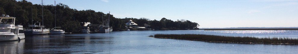
The 120 mile overnight run from St Barts to St John was uneventful and we made good time. Craig and I took a mooring in the national park, a really nice area, for a few days before Alex arrived. The water was an amazing blue and there were turtles all over the place. 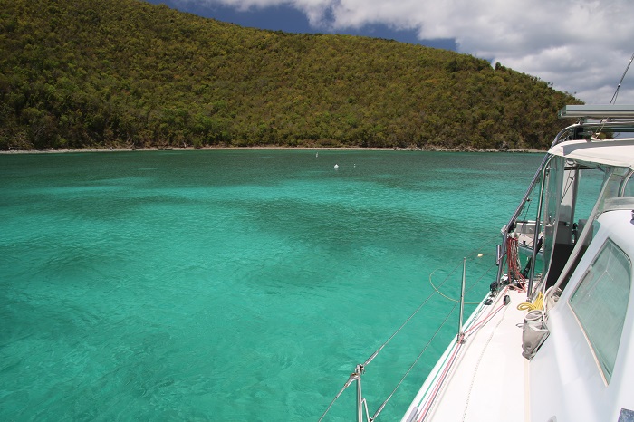 In preparation for our run north, beginning tomorrow, Tuesday, we decided to head to a marina in Red Hook, on St Thomas. It’s a lot easier to prepare, getting the dink up on deck and getting provisions from a marina.
 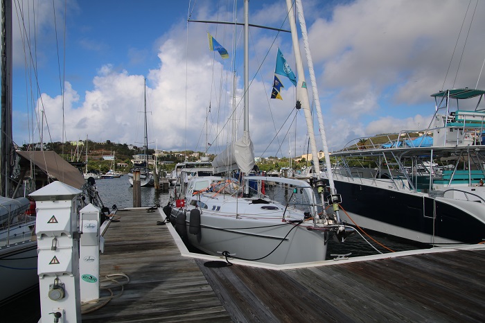 The marina is part of the IGY family of marinas, the same company that runs the one in St Lucia that we stayed at in Rodney Bay. Their rates tend to be a bit more reasonable than others. Plenty of services nearby.
 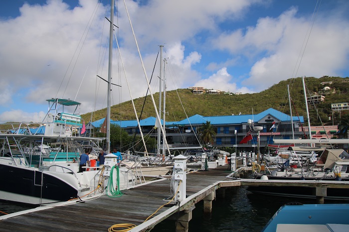 The view of nearby St John this morning as the sun came up, was pretty nice.
 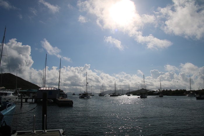 Under the category of “it takes all types” how about this boat near us in the marina. A great party platform, to be sure.
 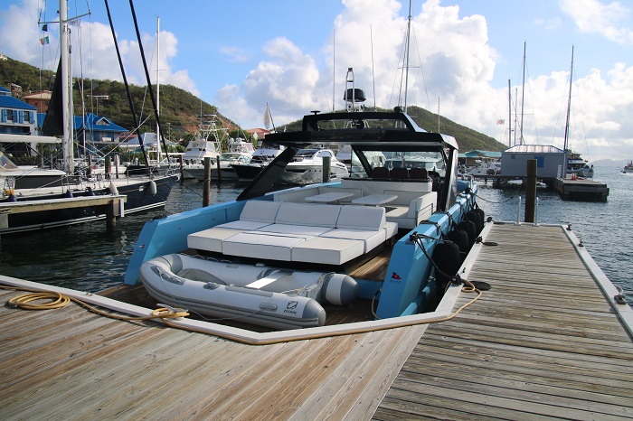 Being in a marina for a few days was a good idea. A bit of luxury, complete with AC, is a good way to begin a long journey.
So on to the passage north.
I have been wondering, and worrying, about what the weather will be like for our 1,300 mile run to Deltaville VA. I am heading there instead of home as I will be having a new lithium battery bank installed along with a wind generator before taking her to New England and home.
We have been relying on Chris Parker for weather routing for a decade as do all of the Salty Dawg Rallies. Chris has a good feel for what sorts of conditions cruisers “of a certain age” look for so he does what he can to help us avoid drama along the way.
Of course, weather is what weather is on a trip of over 3-4 days but he tries to “read the tea leaves” with regards to long range considerations. This is important for a run like ours, that will take perhaps 8-10 days. While the weather for early days of the run are pretty clear, after 5 days it is possible that we will encounter conditions that look a lot different than what it looks like when we head out.
As an additional tool to monitor the weather, I also subscribe to Predict Wind and am able to download weather GRIBS twice a day via the Iridium Go satellite unit. It’s an expensive bit of gear but well worth it for the long passages. By seeing graphically on my screen what I am hearing from Chris Parker’s forecast, I am able to better visualize what he is talking about.
While the confidence of what the forecast is saying is a lot less certain after the first few days, Chris monitors the weather in Canada and the upper atmosphere thousands of miles away to try and get a feel for what is coming our way perhaps a week from now.
I say this as nearly every time I make a long run, Chris’s comments are always something like “well, that’s a long way off and a lot can change” when it comes to the conditions we may face. Also, there just about always seems to be something nasty ahead of us to make the run a bit more arduous.
However, when we had our weather briefing yesterday, Chris was uncharacteristically upbeat with how he described the conditions that we were likely to face on our run north. His comment was something like “I can’t imagine a better forecast”. That’s good, very good.
Without going into too much detail, this is what the current conditions look like for our departure tomorrow. It does look quite alarming up north where there are currently gales. However, by the time we get there the system will have moved out of the area. You can see the various tracks that the computer has recommended based on a number of different weather models. See the boat icon, Pandora, at the bottom of the image.
It’s a bit hard to see but the green areas are wind in the mid teens and we will be on a broad reach. Not ideal, as I’d like a bit more wind when it’s behind us, but pretty good. 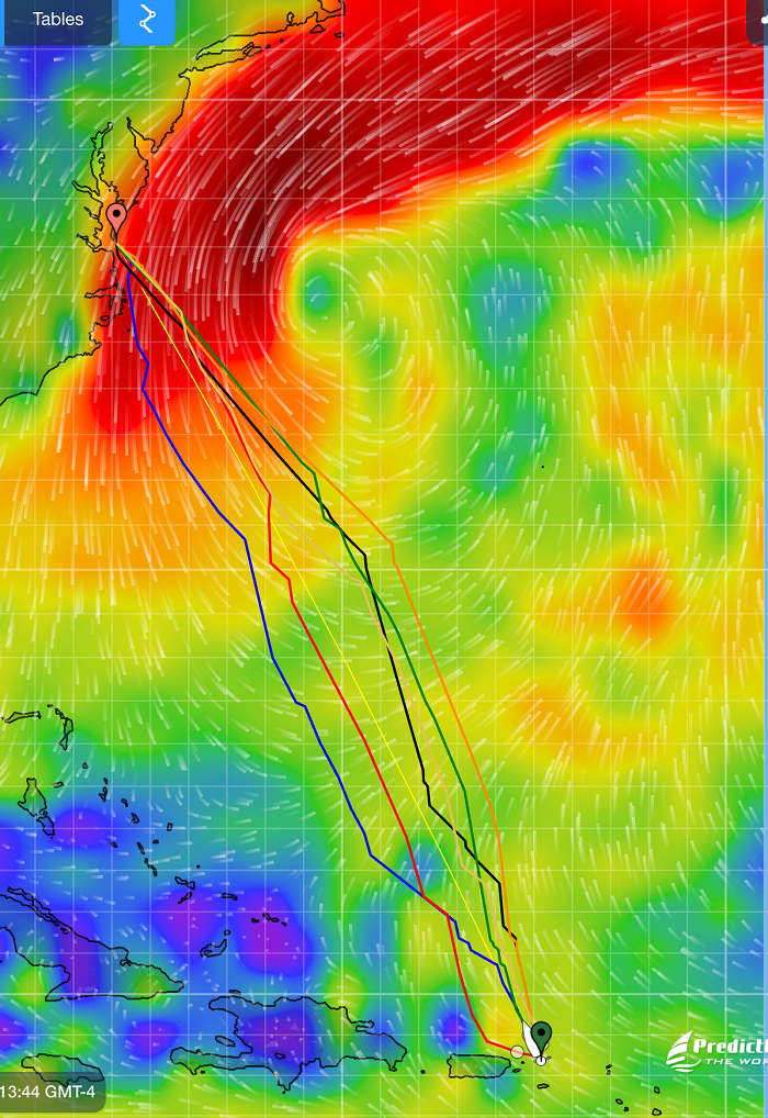 As we make our way north, conditions continue to be good with favorable winds, and you can see that the nasty low has moved out of the area. We will continue to have wind aft of the beam, and hopefully it will be strong enough to keep us moving at a good speed.
 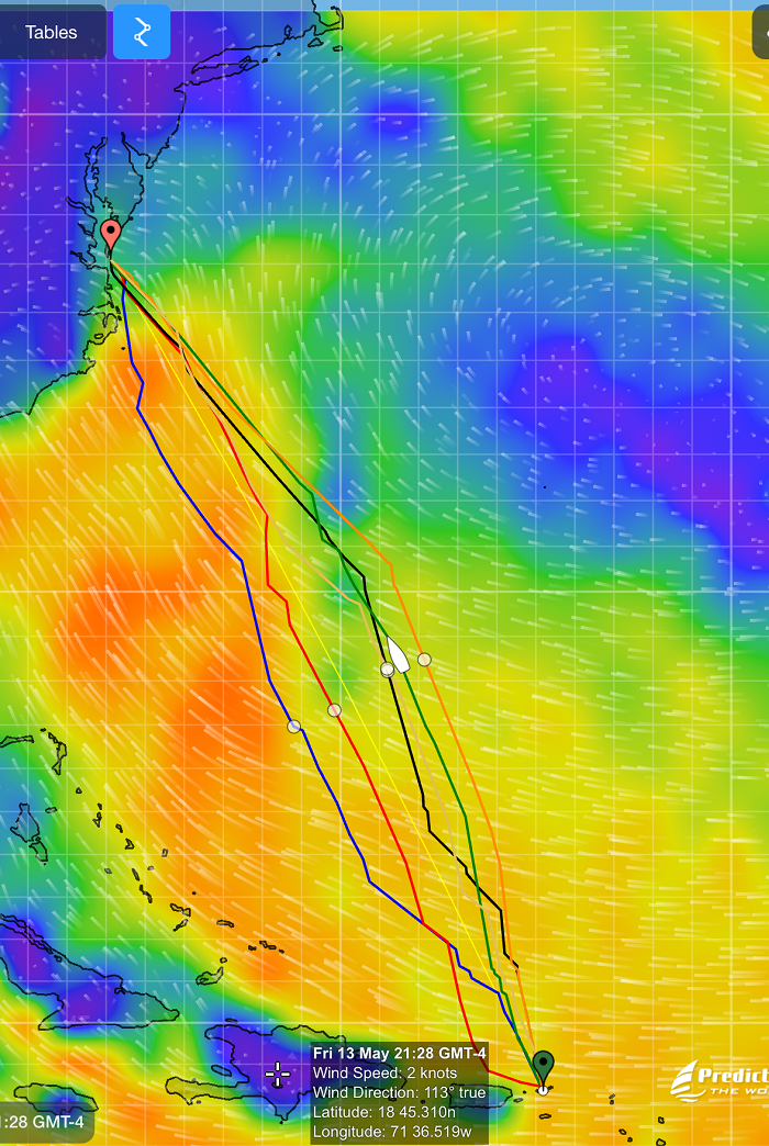 Finally, as we approach the US east coast, there is a bit of uncertainty with a weak low forecasted to exit the coast. Again, Chris feels a high degree of confidence that it will not amount to much. Fingers crossed that it will be long gone by the time we cross the gulf stream off of Cape Hatteras and arrive at the mouth of the Chesapeake Bay.
 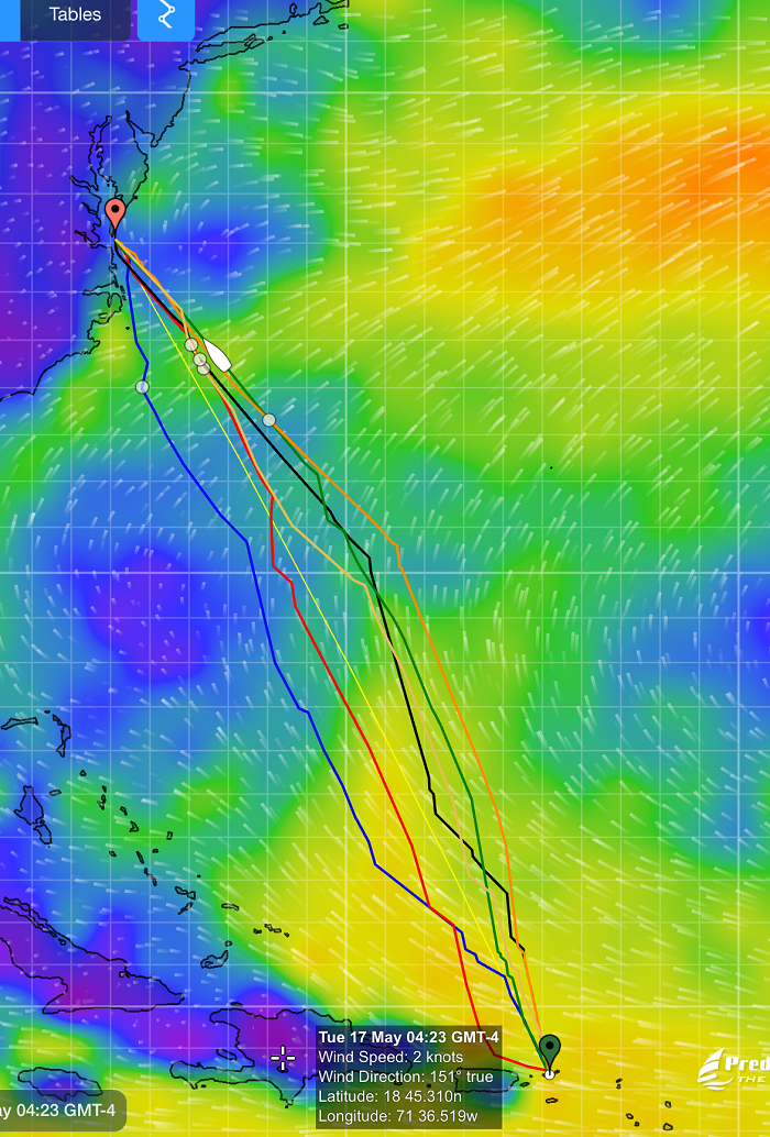 All and all, it looks like the wind will be favorable for the entire trip if perhaps a bit light at times. Light wind isn’t a huge problem as I have plenty of fuel, so bring it on.
Over the years of working with Chris and getting his forecasts, there always seems to have been something on the horizon that is particularly worrisome but this time I am encouraged by Chris’s upbeat assessment of what lies ahead.
Just for fun, if you want to follow the fleet for the run home, check out this link to the Salty Dawg Homeward Bound rally page and see where we are relative to the rest of the fleet. There is a list of the participating boats to the right and you can click on Pandora to see where we are at any given time. If you don’t see the list of boats on that page follow this link to my own dedicated predict wind page. which is a bit easier to use but leaves out the other boats. The tracker will update our position every few hours as we make our way north.
Let’s hope that when we arrive in Deltaville that we will look back and say “that was the best forecast ever!”
I’m counting on it, I hope…
2 responses to “The best possible weather forecast, I hope…”